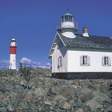
Rakan, منارة في السويد
Location: Skellefteå Municipality
Inception: 1959
Height: 11 m
GPS coordinates: 64.64611,21.29722
Latest update: June 14, 2024 20:09
Gåsören lighthouse
2.1 km
Djävulsviken övre
3.8 km
Gåsören old lighthouse
2.1 km
Näsudden övre
3.9 km
Kallholmen övre
4.7 km
Kallholmen nedre
4.7 km
Djävulsviken nedre
3.5 km
Skellefteå stad 374:1
5 km
Kopparudden
1.9 km
Näsudden nedre
4 km
Tjuvkistan upper light
4 km
Skellefte Oljehamn övre
4.5 km
Tjuvkistan green lower light
3.8 km
Sör-Olsgrundet
1.2 km
Skelleftehamn lighthouse
5 km
Näsgrundet
2.1 km
Skellefte oil port lower light
4.1 km
Skellefteå Pilot Harbor light
3.3 km
Tjuvkistan red lower light
3.8 km
Norra Olsgrundet
1.9 km
Bureå upper light
4.5 km
Bureå lower light
4.1 km
Olsen
2 km
Bure arkiv
4.2 km
Forum museum Rönnskär
3.4 km
Bureå 61:1
4.8 km
Bureå 73:1
3.9 km
Skellefteå stad 373:1
5 kmReviews
Visited this place? Tap the stars to rate it and share your experience / photos with the community! Try now! You can cancel it anytime.
Discover hidden gems everywhere you go!
From secret cafés to breathtaking viewpoints, skip the crowded tourist spots and find places that match your style. Our app makes it easy with voice search, smart filtering, route optimization, and insider tips from travelers worldwide. Download now for the complete mobile experience.

A unique approach to discovering new places❞
— Le Figaro
All the places worth exploring❞
— France Info
A tailor-made excursion in just a few clicks❞
— 20 Minutes