Trollharen upper light, en ensfyr i Söderhamns kommun
Location: Söderhamn Municipality
Inception: 1934
GPS coordinates: 61.08881,17.19767
Latest update: June 14, 2024 20:09
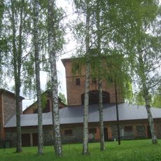
Axmar bruk
5.4 km
Axmar
4 km
Svartstensudden
8.6 km
Skärjån
7.3 km
Högharen
4.3 km
Kushällan
6.2 km
Sunnan
1.6 km
Hamrånge 178:1
7.3 km
Trollharen lower light
42 m
Hamrånge 177:1
7.1 km
Skog 108:1
2.6 km
Vallsbacken
9.1 km
Hamrånge 290:1
8.8 km
Sundsmar lighthouse
8.5 km
Skog 102:2
1.6 km
Söderala 111:2
5.3 km
Söderala 107:2
6.7 km
Söderala 107:1
6.6 km
Skog 101:1
2.5 km
Skog 104:1
6.7 km
Söderala 108:1
6.9 km
Söderala 866
7.7 km
Skog 103:1
6.8 km
Söderala 111:1
5.3 km
Skog 107:1
4.9 km
Hamrånge 124:1
8.9 km
Skog 102:1
1.6 km
Hamrånge 152:1
9.2 kmReviews
Visited this place? Tap the stars to rate it and share your experience / photos with the community! Try now! You can cancel it anytime.
Discover hidden gems everywhere you go!
From secret cafés to breathtaking viewpoints, skip the crowded tourist spots and find places that match your style. Our app makes it easy with voice search, smart filtering, route optimization, and insider tips from travelers worldwide. Download now for the complete mobile experience.

A unique approach to discovering new places❞
— Le Figaro
All the places worth exploring❞
— France Info
A tailor-made excursion in just a few clicks❞
— 20 Minutes