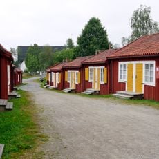
Kallviken lower light, en ensfyr i Skellefteå kommun
Location: Skellefteå Municipality
Inception: 1980
GPS coordinates: 64.32836,21.37214
Latest update: June 14, 2024 20:09
Lövångers kommun
5.3 km
Avanäset
3.6 km
Gärdefjärden
6.4 km
Lappmyrbergets naturreservat
5 km
Lövånger 22:2
6 km
Munkviken
2.1 km
Kallviksklubben
3.1 km
Lövånger 327:1
5.9 km
Lövånger 347:1
3.4 km
Lövånger 305:1
3.5 km
Lövselefjärden lower light
6.6 km
Lövånger 304:2
3.5 km
Lövselefjärden upper light
6.6 km
Lövånger 94:1
5.1 km
Kallviken upper light
100 m
Lövånger 22:1
6 km
Lövånger 332:1
3.9 km
Lövånger 332:2
3.9 km
Lövånger 304:1
3.5 km
Lövånger 336:1
3.1 km
Lövånger 20:1
6.6 km
Lövånger 24:1
5.6 km
Lövånger 88:1
3.4 km
Lövångers sockenmuseum
5.3 km
Lövånger 35:1
4.6 km
Lövånger 324:1
4.4 km
Lövånger 305:2
3.5 km
Lövånger 338:1
2.8 kmReviews
Visited this place? Tap the stars to rate it and share your experience / photos with the community! Try now! You can cancel it anytime.
Discover hidden gems everywhere you go!
From secret cafés to breathtaking viewpoints, skip the crowded tourist spots and find places that match your style. Our app makes it easy with voice search, smart filtering, route optimization, and insider tips from travelers worldwide. Download now for the complete mobile experience.

A unique approach to discovering new places❞
— Le Figaro
All the places worth exploring❞
— France Info
A tailor-made excursion in just a few clicks❞
— 20 Minutes