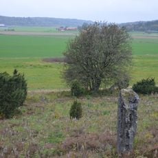
Hanhals 56:1, stone setting in Kungsbacka Municipality, Halland County, Sweden
Location: Kungsbacka Municipality
GPS coordinates: 57.47156,12.09917
Latest update: November 16, 2025 16:47
Fjärås 1:1
2.1 km
Hanhals 15:2
1.9 km
Hanhals 55:1
1.8 km
Tölö 1:2
2.2 km
Fjärås 20:1
1.9 km
Kungsbacka 3:1
485 m
Hanhals 59:1
657 m
Hanhals 57:1
549 m
Hanhals 25:1
2.1 km
Kungsbacka 19:1
2 km
Hanhals 58:1
634 m
Hanhals 26:1
1.9 km
Hanhals 72:1
2 km
Hanhals 62:1
1.3 km
Hanhals 61:1
1.2 km
Fjärås 19:1
2.1 km
Kungsbacka 2:1
344 m
Hanhals 60:1
816 m
Hanhals 13:1
2.1 km
Hanhals 14:1
2 km
Hanhals 60:3
849 m
Fjärås 2:1
1.9 km
Hanhals 62:2
1.2 km
Hanhals 83:1
2 km
Hanhals 15:3
1.9 km
Hanhals 28:1
1.8 km
Hanhals 82:1
2.1 km
Sankta Gertruds kapell
777 mReviews
Visited this place? Tap the stars to rate it and share your experience / photos with the community! Try now! You can cancel it anytime.
Discover hidden gems everywhere you go!
From secret cafés to breathtaking viewpoints, skip the crowded tourist spots and find places that match your style. Our app makes it easy with voice search, smart filtering, route optimization, and insider tips from travelers worldwide. Download now for the complete mobile experience.

A unique approach to discovering new places❞
— Le Figaro
All the places worth exploring❞
— France Info
A tailor-made excursion in just a few clicks❞
— 20 Minutes