Östra Frölunda 3:1, stenkrets i Västergötland
Location: Svenljunga Municipality
GPS coordinates: 57.29580,13.00718
Latest update: November 14, 2025 14:28

Kindahus
4.7 km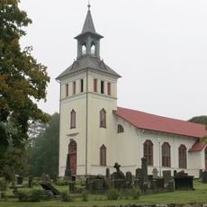
Mårdaklevs kyrka
4.2 km
Klev
4.5 km
Östra Frölunda 59:1
2.4 km
Östra Frölunda 4:1
2.3 km
Östra Frölunda 59:2
2.4 km
Östra Frölunda 12:1
3.9 km
Gamla Strömsholm
1.1 km
Mårdaklev 84:1
3.4 km
Östra Frölunda 58:2
2.6 km
Gamla Strömsholm
1 km
Östra Frölunda 58:4
2.6 km
Östra Frölunda 58:5
2.5 km
Mårdaklev 40:1
3.3 km
Östra Frölunda 60:1
2.2 km
Östra Frölunda 10:1
4.2 km
Östra Frölunda 14:1
2.5 km
Gamla Strömsholm
1 km
Östra Frölunda 3:2
11 m
Östra Frölunda 11:1
3.9 km
Östra Frölunda 58:1
2.6 km
Östra Frölunda 58:3
2.6 km
Östra Frölunda 42:1
3.4 km
Östra Frölunda 14:2
2.6 km
Östra Frölunda 58:6
2.5 km
Mårdaklev 24:1
4.5 km
Mårdaklev 7:1
4.5 km
Gamla Strömsholm
966 mReviews
Visited this place? Tap the stars to rate it and share your experience / photos with the community! Try now! You can cancel it anytime.
Discover hidden gems everywhere you go!
From secret cafés to breathtaking viewpoints, skip the crowded tourist spots and find places that match your style. Our app makes it easy with voice search, smart filtering, route optimization, and insider tips from travelers worldwide. Download now for the complete mobile experience.

A unique approach to discovering new places❞
— Le Figaro
All the places worth exploring❞
— France Info
A tailor-made excursion in just a few clicks❞
— 20 Minutes