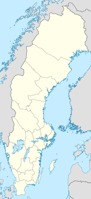
Björnberget, mountain in Sweden; geonames ID = 2721865
Location: Ytterlännäs District
GPS coordinates: 62.91933,17.46454
Latest update: November 23, 2025 10:50
Ytterlännäs parish
6.9 km
Gudmundrå parish
8.2 km
Döraberget
10 km
Sör-Lappmyran
7.1 km
Älgberget-Björnberget
1.4 km
Bastusjöklippen
10.7 km
Nävertjärnsdalen
1.8 km
Nävertjärnsskogen
5.3 km
Edskullen
4.2 km
Habborsbergen
4.6 km
Grenigtmyran
7.7 km
Långvattenhöjden
4.9 km
Sundsjöhöjdens naturreservat
4.3 km
Drickesmyrhöjden
2.6 km
Habborskullarna
5.1 km
Storvattenkullen-Bjuktemyrberget
10.7 km
Finn-Stenbittjärnsbäcken
4.1 km
Hugstmyrhöjden
6.5 km
Hammarshöjden
9.1 km
Björnsjöbodarna
5.9 km
Ytterlännäs 23:1
11.1 km
Stensättersbodarna
5.8 km
Hammarsbodarna
10 km
Forsedsbodarna
8.2 km
Nordansjöbodarna
10 km
Näsfäboan
9.2 km
Bölenfäbodarna
11.3 km
Ramsjöfäbodar
11.9 kmReviews
Visited this place? Tap the stars to rate it and share your experience / photos with the community! Try now! You can cancel it anytime.
Discover hidden gems everywhere you go!
From secret cafés to breathtaking viewpoints, skip the crowded tourist spots and find places that match your style. Our app makes it easy with voice search, smart filtering, route optimization, and insider tips from travelers worldwide. Download now for the complete mobile experience.

A unique approach to discovering new places❞
— Le Figaro
All the places worth exploring❞
— France Info
A tailor-made excursion in just a few clicks❞
— 20 Minutes