Việt Hưng, ward of Long Bien district, Hanoi city, Vietnam
Location: Long Biên
Elevation above the sea: 9 m
GPS coordinates: 21.05472,105.90139
Latest update: November 25, 2023 00:17

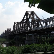
Long Bien Bridge
4.6 km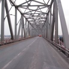
Chương Dương Bridge
4.6 km
Dong Tru Bridge
3.1 km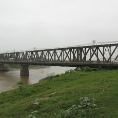
Duong River Bridge
2.7 km
Phu Dong Bridge
4.2 km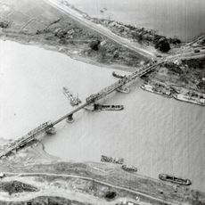
Sông Bé Bridge
2.7 km
Statue of Xuanwu
3.6 km
Bia Tưởng Niệm Liệt Sĩ
3.8 km
Đài Tưởng Niệm Liệt Sĩ
1.8 km
Tượng đài Hồ Chí Minh
3 km
Đài tưởng niệm liệt sĩ phường Phúc Lợi
3 km
Memorial
1.3 km
Công viên Ngọc Thụy
3.2 km
Great view of Song Duong
3.4 km
Xuân thu vườn
519 m
Đài Liệt Sĩ Phường Bồ Đề
3.6 km
Tran Vu temple
3.6 km
Memorial
2.3 km
Công viên Long Biên
771 m
Scenic viewpoint
4.5 km
Scenic viewpoint
4.5 km
Tượng Quan Thế Âm
4.5 km
Đình Chùa Vàng
4.5 km
Công viên Long Biên
657 m
Water house in Truong Lam village
634 m
Scenic viewpoint
4.7 km
Scenic viewpoint
4.7 km
Scenic viewpoint
4.9 kmReviews
Visited this place? Tap the stars to rate it and share your experience / photos with the community! Try now! You can cancel it anytime.
Discover hidden gems everywhere you go!
From secret cafés to breathtaking viewpoints, skip the crowded tourist spots and find places that match your style. Our app makes it easy with voice search, smart filtering, route optimization, and insider tips from travelers worldwide. Download now for the complete mobile experience.

A unique approach to discovering new places❞
— Le Figaro
All the places worth exploring❞
— France Info
A tailor-made excursion in just a few clicks❞
— 20 Minutes