Monckton Nii Luutiksm Conservancy, protected area in British Columbia, Canada
Location: North Coast Regional District
GPS coordinates: 53.33556,-129.66028
Latest update: November 22, 2025 14:56

Union Passage Marine Provincial Park
16.9 km
Klewnuggit Inlet Marine Provincial Park
39.1 km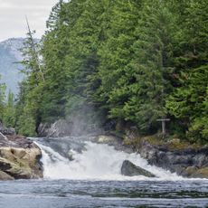
Lowe Inlet Marine Provincial Park
25.1 km
K'mooda/Lowe-Gamble Conservancy
29.5 km
K'distsausk/Turtle Point Conservancy
25.2 km
Alty Conservancy
37.3 km
Dewdney and Glide Islands Ecological Reserve
40.1 km
Ethelda Bay-Tennant Island Conservancy
31 km
Simpson Lake East Conservancy
35.4 km
Lax Kwil Dziidz/Fin Conservancy
23.4 km
K'tisgaidz/Macdonald Bay Conservancy
26.8 km
K'waal Conservancy
41.4 km
Lax Ka'gaas/Campania Conservancy
32.1 km
Verney Falls
25.8 km
Purple Cliff
38.7 km
Freda Rapids
37.5 km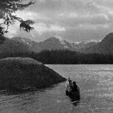
Lowe Inlet
24.4 km
Mark Bluff
24.3 km
Maxtaktsm'Aa/Union Passage Conservancy
13.8 km
Waterfall
31.3 km
Waterfall
29.7 km
Waterfall
30.6 km
Waterfall
36.6 km
Waterfall
36.2 km
Waterfall
25.9 km
Verney Falls
25.8 km
Waterfall
26.3 km
Waterfall
26.7 kmReviews
Visited this place? Tap the stars to rate it and share your experience / photos with the community! Try now! You can cancel it anytime.
Discover hidden gems everywhere you go!
From secret cafés to breathtaking viewpoints, skip the crowded tourist spots and find places that match your style. Our app makes it easy with voice search, smart filtering, route optimization, and insider tips from travelers worldwide. Download now for the complete mobile experience.

A unique approach to discovering new places❞
— Le Figaro
All the places worth exploring❞
— France Info
A tailor-made excursion in just a few clicks❞
— 20 Minutes