Morin Heights United Church, church building in Morin-Heights, Quebec
Location: Morin-Heights
Inception: 1880
Address: 831, chemin du Village
GPS coordinates: 45.90235,-74.25218
Latest update: December 1, 2025 01:51

Mont Habitant
6.8 km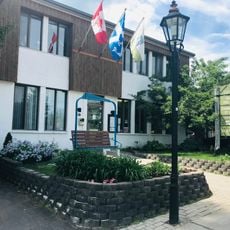
Laurentian Ski Museum
7.3 km
Pont de la Rivière-à-Simon
7.6 km
Parc John-H.-Molson
5.7 km
Parc Camil-Michel
5.7 km
La Marquise
5.1 km
Pont Constantineau
6.7 km
Pont de Val-Royal
6.7 km
Venues used by Festival des Arts de Saint-Sauveur
7.4 km
Pont Dainava
6.1 km
Site du patrimoine de Saint-Sauveur-des-Monts
7.4 km
Lookout
2.5 km
Scenic viewpoint
1 km
Club de golf Mont-Gabriel
7 km
Golf Mont-Gabriel
7.3 km
Scenic viewpoint
4.5 km
Scenic viewpoint
4 km
Scenic viewpoint
5.9 km
Scenic viewpoint
5.9 km
Scenic viewpoint
5.8 km
Balmoral Golf Club
2.2 km
Cap Bruce-Foy
5.7 km
Scenic viewpoint
7.4 km
Rocher capitaine
7 km
Scenic viewpoint
6.2 km
Capteur de rêves
6.2 km
Caput
6.5 km
Cap à l'Aigle
7.4 kmReviews
Visited this place? Tap the stars to rate it and share your experience / photos with the community! Try now! You can cancel it anytime.
Discover hidden gems everywhere you go!
From secret cafés to breathtaking viewpoints, skip the crowded tourist spots and find places that match your style. Our app makes it easy with voice search, smart filtering, route optimization, and insider tips from travelers worldwide. Download now for the complete mobile experience.

A unique approach to discovering new places❞
— Le Figaro
All the places worth exploring❞
— France Info
A tailor-made excursion in just a few clicks❞
— 20 Minutes