Backhaus, cultural heritage monument D-3-75-120-42 (0) in Brennberg, Bavaria
Location: Brennberg
Address: Nähe St.-Rupert-Straße
GPS coordinates: 49.07075,12.39818
Latest update: June 14, 2024 14:07
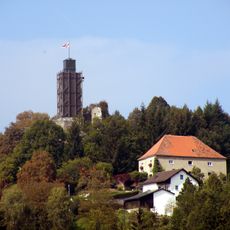
Burg Brennberg
195 m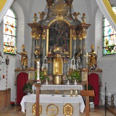
Sankt Rupert
57 m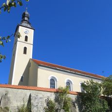
Katholische Pfarrkirche St. Rupert
61 m
Hofmauer Staufferweg 3 in Brennberg
143 m
Turm Hofberg; Nähe Staufferweg in Brennberg
189 m
Turm Nähe Staufferweg in Brennberg
174 m
Friedhofsmauer St.-Rupert-Straße 1 in Brennberg
69 m
Cultural heritage D-3-6940-0116 in Brennberg
69 m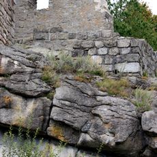
Burgberg bei Brennberg
194 m
Palas Nähe Staufferweg in Brennberg
136 m
Burgkapelle Lerchenfeldstraße 10 in Brennberg
157 m
Cultural heritage D-3-6940-0006 in Brennberg
147 m
Pferdestall Nähe Staufferweg in Brennberg
147 m
Sommerkeller Nähe Staufferweg in Brennberg
163 m
Kreuz St.-Rupert-Straße 1 in Brennberg
44 m
Ehemaliger Getreidespeicher
155 m
Schloss Nähe Staufferweg in Brennberg
105 m
Ringmauer Nähe Staufferweg in Brennberg
155 m
Schloss Hofberg; Nähe Staufferweg in Brennberg
158 m
Ehemaliges Benefizium
150 m
Backhaus Lerchenfeldstraße 10 in Brennberg
164 m
Ehemaliger Pfarrhof
173 m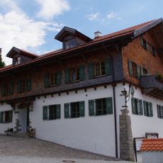
Gasthaus
66 m
Gasthof
206 m
Kriegerdenkmal
133 m
Scenic viewpoint
132 m
Scenic viewpoint
129 m
Auerturm
203 mReviews
Visited this place? Tap the stars to rate it and share your experience / photos with the community! Try now! You can cancel it anytime.
Discover hidden gems everywhere you go!
From secret cafés to breathtaking viewpoints, skip the crowded tourist spots and find places that match your style. Our app makes it easy with voice search, smart filtering, route optimization, and insider tips from travelers worldwide. Download now for the complete mobile experience.

A unique approach to discovering new places❞
— Le Figaro
All the places worth exploring❞
— France Info
A tailor-made excursion in just a few clicks❞
— 20 Minutes