
Boundary Stone 400 Yards South West Of Stanley Farmhouse
Boundary Stone 400 Yards South West Of Stanley Farmhouse, boundary marker in Linch, Chichester, West Sussex, UK
Location: Linch
Part of: political border
GPS coordinates: 51.06017,-0.77380
Latest update: November 22, 2025 08:57
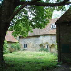
Shulbrede Priory
1.6 km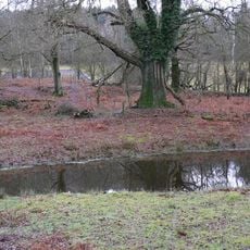
Lynchmere Commons
1.4 km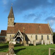
The Parish Church of St Peter
1.5 km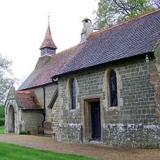
Church of St Luke
2.2 km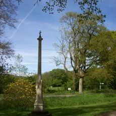
Linch War Memorial
1.9 km
Bridge Farmhouse
2.2 km
Goldenfield West Lychgate
1.8 km
Barn At Woodmansgreen Farm To The South East Of The Farmhouse
2.3 km
Hirtwell
1 km
Linchmere Farmhouse
1.5 km
Stanley Farmhouse
406 m
Wardley Cottage
2 km
Two Ranges Of Farm Buildings At Home Farm, Hollycombe, To The South Of The Farmhouse
1.7 km
Hollycombe
997 m
Home Farmhouse, Hollycombe
1.6 km
The Garden Wall Of Hollycombe To The West Of The House
1 km
The Old Cottage
2.3 km
Woodmansgreen Farmhouse
2.2 km
Sawmill House The Old Sawmill The Old Sawmill And The Cottage Adjoining
1.6 km
Clouds Hill
1.5 km
The Former Hollycombe Engine House
1.6 km
Little Boarhunt
2.4 km
Covers
1.3 km
Garden Walls And Pavilion Of Little Boarhunt
2.4 km
Green Hill
2.2 km
Church Cottage
2.1 km
Scenic viewpoint
755 m
Scenic viewpoint
769 mReviews
Visited this place? Tap the stars to rate it and share your experience / photos with the community! Try now! You can cancel it anytime.
Discover hidden gems everywhere you go!
From secret cafés to breathtaking viewpoints, skip the crowded tourist spots and find places that match your style. Our app makes it easy with voice search, smart filtering, route optimization, and insider tips from travelers worldwide. Download now for the complete mobile experience.

A unique approach to discovering new places❞
— Le Figaro
All the places worth exploring❞
— France Info
A tailor-made excursion in just a few clicks❞
— 20 Minutes