1-4, the Green, building in Warehorne, Ashford, Kent, UK
Location: Warehorne
Address: 1-4, The Green, Warehorne, Ashford, Kent, TN26
GPS coordinates: 51.05843,0.83803
Latest update: November 9, 2025 14:11
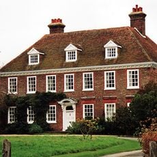
Leacon Hall
560 m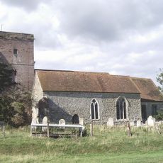
Church of St Matthew
104 m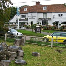
The Woolpack Inn
74 m
Bluebell Cottage
769 m
The Leacon
501 m
Leacon Farmhouse
907 m
Chest Tomb And Headstone 1 To 3 Metres South Of Church Of St Matthew
118 m
Headstone To Margaret Burges, About 4 Metres South Of Church Of St Matthew
120 m
Chest Tomb And Headstone About 15 Metres South West Of Church Of St Matthew
128 m
Chest Tomb About 50 Metres South West Of Church Of St Matthew
150 m
Headstone To Richard Jervis, About 10 Metres South West Of Church Of St Matthew
122 m
House 30 Metres West Of Stone Farmhouse
994 m
Mill House
610 m
Church Farmhouse
102 m
Chest Tomb To Hodges Family, About 15 Metres South Of Church Of St Matthew
125 m
Churchfield Terrace
30 m
Oasthouse About 25 Metres North West Of Burr Farmhouse
774 m
Tinton
305 m
Royal Military Canal, Warehorne Bridge to Ham Street Bridge
915 m
Pilgrims Cottages
43 m
Burr Farmhouse
749 m
Royal Military Canal, Kenardington Bridge to Warehorne Bridge
924 m
Mountfield
87 m
Chest Tomb To Hodges Family, About 2 Metres South Of Church Of St Matthew
118 m
Two Headstones To Down Family About 20 Metres South West Of Church Of St Matthew
131 m
Lilyfields
782 m
Stone Farmhouse
946 m
Gold House
473 mReviews
Visited this place? Tap the stars to rate it and share your experience / photos with the community! Try now! You can cancel it anytime.
Discover hidden gems everywhere you go!
From secret cafés to breathtaking viewpoints, skip the crowded tourist spots and find places that match your style. Our app makes it easy with voice search, smart filtering, route optimization, and insider tips from travelers worldwide. Download now for the complete mobile experience.

A unique approach to discovering new places❞
— Le Figaro
All the places worth exploring❞
— France Info
A tailor-made excursion in just a few clicks❞
— 20 Minutes