Kings Toll Farmhouse, farmhouse in Brenchley, Tunbridge Wells, Kent, UK
Location: Brenchley and Matfield
GPS coordinates: 51.13905,0.35312
Latest update: November 28, 2025 14:56
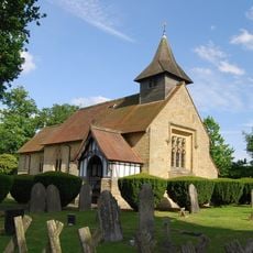
Chapel Of Ease Of St Luke
802 m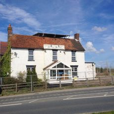
The Blue Boys Inn
470 m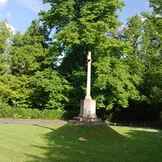
Matfield War Memorial
849 m
Barn About 50 Metres North West Of Old Farm Farmhouse
1.4 km
Romford Farmhouse
1.1 km
Hazelwood
1.2 km
The Forresters
1.1 km
Ambleford
1.3 km
Old Cryals
1.4 km
Mays Farmhouse
1.1 km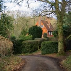
Foxella
1.1 km
Pastheap Farmhouse
1.1 km
Storr Memorial About 20 Metres South East Of The Chancel Of The Chapel Of Ease Of St Luke
811 m
Barn About 10 Metres South East Of Hodges
570 m
Elmhurst
984 m
Romford House
905 m
Slowery Farmhouse
694 m
Wellgrove Farmhouse
859 m
Row Of 4 Sharp Chest Tombs Immediately South East Of The Chancel Of The Chapel Of Ease Of St Luke
803 m
Wilshin Memorial Immediately South Of The Vestry Of The Chapel Of Ease Of St Luke
798 m
Hodges
552 m
Kippings Cross Farmhouse
442 m
South East Lychgate To The Chapel Of Ease Of St Luke
798 m
Oasthouse About 30 Metres North Of Old Farm Farmhouse
1.5 km
Mays Barn
1.1 km
Stantons
1.3 km
North West Lychgate To The Chapel Of Ease Of St Luke
801 m
Oasthouse Approximately 20 Metres South West Of Romford House
873 mReviews
Visited this place? Tap the stars to rate it and share your experience / photos with the community! Try now! You can cancel it anytime.
Discover hidden gems everywhere you go!
From secret cafés to breathtaking viewpoints, skip the crowded tourist spots and find places that match your style. Our app makes it easy with voice search, smart filtering, route optimization, and insider tips from travelers worldwide. Download now for the complete mobile experience.

A unique approach to discovering new places❞
— Le Figaro
All the places worth exploring❞
— France Info
A tailor-made excursion in just a few clicks❞
— 20 Minutes