The White House, house in East Chiltington, Lewes, East Sussex, UK
Location: East Chiltington
GPS coordinates: 50.91856,-0.03543
Latest update: November 20, 2025 07:52
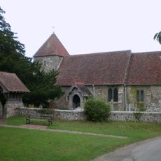
The Parish Church
1.2 km
Wickhams Cottage
616 m
Pouchlands Cottages
2.1 km
Warningore Farm Cottages
1.5 km
Rafters
505 m
Thatchers Cottage
1.2 km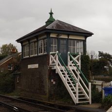
Plumpton Signal Box
2 km
Woodbrooks Farmhouse
1.6 km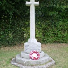
East Chiltington War Memorial
1.2 km
Little Cleers
1.4 km
Lower Burrells
521 m
Bevernbridge House
1.8 km
Kemps
516 m
Wickham Lane
1.4 km
Upper Mill
1.9 km
Chapel Farmhouse
1.3 km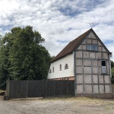
Barn Or Stables To West Of Stantons Farmhouse
1.1 km
Holters Green
1.8 km
Rylands
1.8 km
The Former Mill Building, Old Mill House
1.8 km
Allington Farmhouse
1.5 km
Upper Burrells
566 m
Hurst Barns Farmhouse
964 m
Drapers Farm Cottage Yokehurst Farm Cottage
1.8 km
106 And 107, Plumpton Lane
1.9 km
Mill Cottage, Upper Mill
1.9 km
Stantons Farmhouse
1.1 km
Old Mill House
1.8 kmReviews
Visited this place? Tap the stars to rate it and share your experience / photos with the community! Try now! You can cancel it anytime.
Discover hidden gems everywhere you go!
From secret cafés to breathtaking viewpoints, skip the crowded tourist spots and find places that match your style. Our app makes it easy with voice search, smart filtering, route optimization, and insider tips from travelers worldwide. Download now for the complete mobile experience.

A unique approach to discovering new places❞
— Le Figaro
All the places worth exploring❞
— France Info
A tailor-made excursion in just a few clicks❞
— 20 Minutes