
The Green, architectural structure in Lyneham and Bradenstoke, Wiltshire, UK
Location: Lyneham and Bradenstoke
GPS coordinates: 51.51206,-1.97164
Latest update: November 15, 2025 10:24
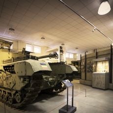
REME Museum Car Park
787 m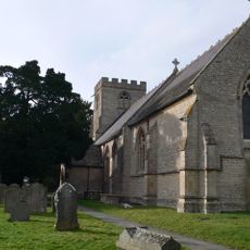
Church of St Michael and All Angels
596 m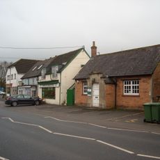
Lyneham Library
637 m
Red Lion Cottage
1.6 km
Earthwork, south of Hillocks Wood
1.3 km
Milestone At Ngr Su 030803
1.4 km
Spackman Chest Tomb, 8 Metres South Of Nave Wall East Of Porch, In The Churchyard, Church Of St Michael
608 m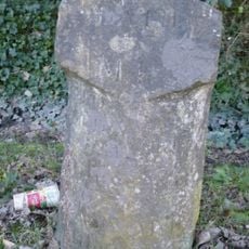
Milestone Opposite No 85 (Post Office)
267 m
Preston House
1.8 km
Manor House Farmhouse
1.7 km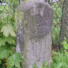
Milestone Opposite No 23 Calne Road
716 m
Tockenham Court Farmhouse
1.3 km
Church Farm
337 m
Barn At Preston East Farm
1.8 km
52, Calne Road
241 m
Meadow Court
1.6 km
Mounting Block Adjacent To Street Entrance To Path To Church Of St Michael
630 m
Barrow Farm Cottage
646 m
Greenlands
84 m
57, The Green
9 m
Shaw Farmhouse
1.7 km
Heath Chest Tomb 2 Metres South Of Nave Wall East Of Porch In The Churchyard, Church Of St Michael
604 m
Bramble Cottage Patrick's Cottage
1.8 km
Building To Rear Of Meadow Court
1.6 km
Old Rectory
469 m
Pound Farmhouse
157 m
LXX (70 Sqn) Daffodils
1.3 km
Westland Lynx
862 mReviews
Visited this place? Tap the stars to rate it and share your experience / photos with the community! Try now! You can cancel it anytime.
Discover hidden gems everywhere you go!
From secret cafés to breathtaking viewpoints, skip the crowded tourist spots and find places that match your style. Our app makes it easy with voice search, smart filtering, route optimization, and insider tips from travelers worldwide. Download now for the complete mobile experience.

A unique approach to discovering new places❞
— Le Figaro
All the places worth exploring❞
— France Info
A tailor-made excursion in just a few clicks❞
— 20 Minutes