
Unidentified Monument, 14 Metres North East Of Chancel, Church Of St Andrew
Unidentified Monument, 14 Metres North East Of Chancel, Church Of St Andrew, monument in Ogbourne St. Andrew, Wiltshire, UK
Location: Ogbourne St Andrew
GPS coordinates: 51.44983,-1.72999
Latest update: November 17, 2025 17:46
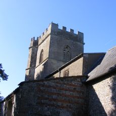
Church of St Andrew
26 m
Old Cottage
82 m
Elm Tree Cottage
1.4 km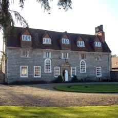
Ogbourne Maisey House
833 m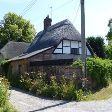
Toll Gate Cottage
1.4 km
Pair Of Large Monuments In Churchyard, 9 Metres South Of Chancel, Church Of St Andrew
26 m
The Haven
810 m
Sunrise Cottage
119 m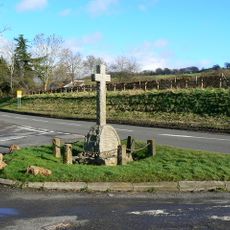
Ogbourne St Andrew War Memorial
294 m
The Thatch
96 m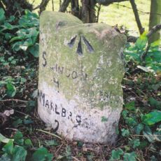
Milestone, East Of Village Centre
328 m
Laurels
1.4 km
Granary At East Holm Farm
107 m
Mound in churchyard
18 m
Poughcombe Farmhouse
91 m
South View
183 m
Tresco House
374 m
East Holm Farmhouse
96 m
Churchyard Wall, Church Of St Andrew
31 m
Bowl barrow 800m south-east of Ogbourne St.Andrew Farm
983 m
The Thatch
701 m
Well Cottage
811 m
1, Southend
1.4 km
South End House
1.4 km
Gatepiers To Ogbourne Maisey House
722 m
Group Of Four Goddard And Associated Monuments In Churchyard, 3 Metres To 7 Metres North Of Chancel, Church Of St Andrew
15 m
The Forge
152 m
Ogbourne St Andrew
152 mReviews
Visited this place? Tap the stars to rate it and share your experience / photos with the community! Try now! You can cancel it anytime.
Discover hidden gems everywhere you go!
From secret cafés to breathtaking viewpoints, skip the crowded tourist spots and find places that match your style. Our app makes it easy with voice search, smart filtering, route optimization, and insider tips from travelers worldwide. Download now for the complete mobile experience.

A unique approach to discovering new places❞
— Le Figaro
All the places worth exploring❞
— France Info
A tailor-made excursion in just a few clicks❞
— 20 Minutes