The Former Schoolroom, architectural structure in Plumpton, Lewes, East Sussex, UK
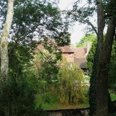
Plumpton Place
382 m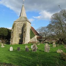
The Parish Church of St Michael and All Angels, Plumpton
741 m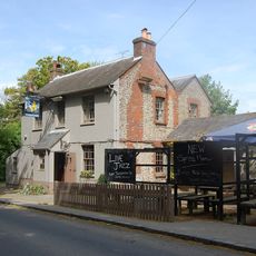
The Half Moon Inn
265 m
Warningore Farm Cottages
1.1 km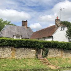
The Eugh
35 m
Upper Mill
1.3 km
Saucer barrow 170m SW of Ditchling Cross, Plumpton Plain
957 m
Oval barrow 775m south of Plumpton Place on Plumpton Plain
950 m
Bowl barrow 200m east of Plumpton Bostall (top end)
990 m
Two bowl barrows north-east of Streathill Farm
1.2 km
Cross dyke and adjacent saucer barrow 850m south east of Ditchling Cross: part of Plumpton Plain round barrow cemetery
987 m
The Mill House
306 m
Two bowl barrows 600m south east of Ditchling Cross: part of Plumpton Plain round barrow cemetery
927 m
Drews Farmhouse
514 m
Cross dyke 730m south east of Ditchling Cross
949 m
The Cottages And Gateway At Plumpton Place To West Of The House
454 m
The Cottage
324 m
Bowl barrow 700m south east of Ditchling Cross: part of Plumpton Plain round barrow cemetery
960 m
Bowl barrow 550m south east of Ditchling Cross: part of Plumpton Plain round barrow cemetery
921 m
Bowl barrow south west of The Beeches: part of Plumpton Plain round barrow cemetery
970 m
Bowl barrow 530m south east of Ditchling Cross: part of Plumpton Plain round barrow cemetery
939 m
106 And 107, Plumpton Lane
995 m
Bowl barrow south of The Beeches: part of Plumpton Plain round barrow cemetery
1 km
Bowl barrow north west of Warningore Bostall: part of Plumpton Plain round barrow cemetery
1.1 km
The Laines
244 m
Part of Plumpton Plain round barrow cemetery and an Anglo-Saxon barrow field south east of Warningore Bostall
1.1 km
Moat Barn, Plumpton Agricultural College
511 m
Mill Cottage, Upper Mill
1.2 kmReviews
Visited this place? Tap the stars to rate it and share your experience / photos with the community! Try now! You can cancel it anytime.
Discover hidden gems everywhere you go!
From secret cafés to breathtaking viewpoints, skip the crowded tourist spots and find places that match your style. Our app makes it easy with voice search, smart filtering, route optimization, and insider tips from travelers worldwide. Download now for the complete mobile experience.

A unique approach to discovering new places❞
— Le Figaro
All the places worth exploring❞
— France Info
A tailor-made excursion in just a few clicks❞
— 20 Minutes