Mortimer Hill, architectural structure in Stratfield Mortimer, West Berkshire, Berkshire, UK
Location: Stratfield Mortimer
GPS coordinates: 51.37559,-1.05381
Latest update: November 22, 2025 18:21
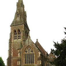
Church of St Mary Church of St Mary 66826410
953 m
Round barrow cemetery at Holden's Firs
1.7 km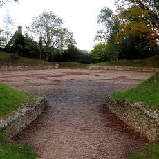
Silchester Amphitheatre
2.4 km
Oates Cottage
1.8 km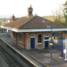
Mortimer Station
1.3 km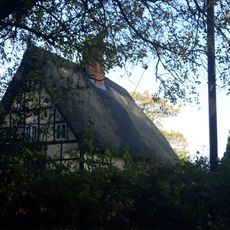
The Mount Farmhouse
2.4 km
Barn 50 Metres To East Of By Lanes
2 km
St Benedict's School Wokefield Park Wokefield Park (st Benedict's School)
1.8 km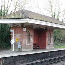
Waiting Room At Mortimer Station On South West Side Of Railway Line
1.3 km
Windabout
1.3 km
Granary (2) South-West Of West End Farmhouse
2.3 km
Bowl barrow in Stephen's Firs: an outlier to a barrow cemetery in Holden's Firs
1.5 km
Brocas Lands Farmhouse
1.5 km
The Saddlers
1.3 km
Great Park Farmhouse 6820 6468
2.3 km
Outbuildings, Attached To Granary (1)
2.3 km
Barn (2) To North East Of West End Farmhouse
2.2 km
West End Farmhouse
2.3 km
Harris House
1.1 km
By Lanes
2 km
Granary (1) To North Of Barn (2)
2.3 km
Bowl barrow: part of a barrow cemetery in Holden's Firs
1.6 km
Bowl barrow north of Holden's Firs: part of the Holden's Firs barrow cemetery
1.8 km
Mortimer House
1.2 km
Barn (1) To West Of West End Farmhouse
2.3 km
Foudry House
1 km
Mortimer Station Overbridge
1.4 km
Scenic viewpoint
1.7 kmReviews
Visited this place? Tap the stars to rate it and share your experience / photos with the community! Try now! You can cancel it anytime.
Discover hidden gems everywhere you go!
From secret cafés to breathtaking viewpoints, skip the crowded tourist spots and find places that match your style. Our app makes it easy with voice search, smart filtering, route optimization, and insider tips from travelers worldwide. Download now for the complete mobile experience.

A unique approach to discovering new places❞
— Le Figaro
All the places worth exploring❞
— France Info
A tailor-made excursion in just a few clicks❞
— 20 Minutes