
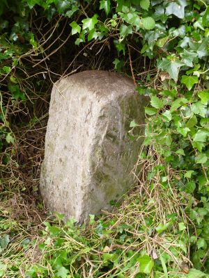
Boundary Stone At Junction With Dagra Lane, boundary marker in Shaldon, Teignbridge, Devon, UK
Location: Shaldon
Part of: political border
GPS coordinates: 50.53873,-3.52660
Latest update: March 9, 2025 08:56
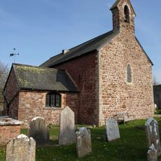
Church of St Nicholas
515 m
Cape Cottage
662 m
Highover Cottage
551 m
Pear Tree Cottage
655 m
Ringmore
886 m
The Old Cottage
603 m
Hill Haye Cottage
651 m
The Hermitage
523 m
Little Harvey And Little Harvey Cottage
368 m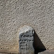
Milestone About 575 Metres North West Of Little Harvey Farmhouse At Sx 910723
935 m
West Wing And Centre House
840 m
Old Stoke House
542 m
Doone Cottage
605 m
Brook House
617 m
Home Farmhouse And Rooster Hall And Attached Front Garden Walls And Gate
599 m
Ringmore House
700 m
Farthings And Attached Walls And Gate Piers
557 m
Belle Vue
602 m
Sparrows Nest
593 m
Ringmore Farm Ringmore Farmhouse
694 m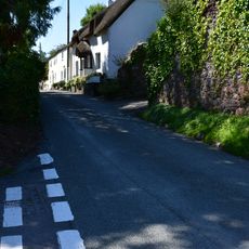
Little Thatch
579 m
70, Ringmore Road
960 m
68, Ringmore Road
970 m
Strand House And Attached Walls And Gate Piers
605 m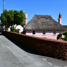
Laurel Farmhouse
563 m
Enfield And Attached Walls And Gate Piers
506 m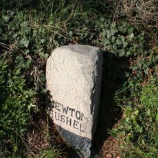
Milestone, Teignmouth Road, in the Viewing Place loop, in new cutting W of Shaldon Bridge
997 m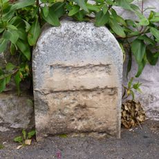
Milestone, Ringmore; on bend by entrance to St Nicholas Church
547 mReviews
Visited this place? Tap the stars to rate it and share your experience / photos with the community! Try now! You can cancel it anytime.
Discover hidden gems everywhere you go!
From secret cafés to breathtaking viewpoints, skip the crowded tourist spots and find places that match your style. Our app makes it easy with voice search, smart filtering, route optimization, and insider tips from travelers worldwide. Download now for the complete mobile experience.

A unique approach to discovering new places❞
— Le Figaro
All the places worth exploring❞
— France Info
A tailor-made excursion in just a few clicks❞
— 20 Minutes