Goodgrooms, building in Salehurst and Robertsbridge, Rother, East Sussex, UK
Location: Salehurst and Robertsbridge
GPS coordinates: 50.99062,0.49114
Latest update: November 21, 2025 07:22

Robertsbridge Abbey
638 m
The Parish Church of St Mary
43 m
The Salehurst Halt Public House
75 m
Abbey Ruins
652 m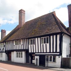
Monk's Cottage, Rother
1.1 km
Church Farm And Cottage Church Farm House
77 m
Oasthouse, Granary And Cartshed At Redlands Farm To The North West Of The Farmhousee
563 m
Barn At Park Farmhouse To The South West Of The Farmhouse
1.1 km
The Oast House
1 km
The Abbey
611 m
Hill House
1.2 km
Park Farmhouse
998 m
Barn And Outbuilding At Park Farm To The West Of The Preceding Barn
1.1 km
Bantony
1.1 km
Redlands Farmhouse
553 m
The Tomb Of Viscount Milner In The Extension Of St Mary's Churchyard To The North East Of The Church
79 m
23, 24 And 25, Fair Lane
1.1 km
The Oasthouse
620 m
Parsonage Farmhouse
109 m
1-5, School Terrace
903 m
Oasthouses And Granary At Parsonage Farm To The North Of The House On The North Side Of The Road
191 m
16, 18 And 20, Northbridge Street
1 km
Post Office Terrace Spoutings, Post Office Terrace
48 m
Bayham
998 m
Quaker Cottage
987 m
Keston Cottage
1 km
Oasthouses And Granary At Moat Farm To The West Of The Farmhouse
848 m
Church Lane Cottages
117 mReviews
Visited this place? Tap the stars to rate it and share your experience / photos with the community! Try now! You can cancel it anytime.
Discover hidden gems everywhere you go!
From secret cafés to breathtaking viewpoints, skip the crowded tourist spots and find places that match your style. Our app makes it easy with voice search, smart filtering, route optimization, and insider tips from travelers worldwide. Download now for the complete mobile experience.

A unique approach to discovering new places❞
— Le Figaro
All the places worth exploring❞
— France Info
A tailor-made excursion in just a few clicks❞
— 20 Minutes