
Garden/Forecourt And Terrace Walls To Congregational Church And Manse
Garden/Forecourt And Terrace Walls To Congregational Church And Manse, architectural structure in Wallington Demesne, Northumberland, UK
Location: Wallington Demesne
GPS coordinates: 55.16066,-1.90486
Latest update: December 2, 2025 05:01

Ox Inn
54 m
Manse Adjacent To Congregational Church
14 m
Western Cottage Adjacent To Manse
22 m
Garden Wall Adjacent To West End Of Corridge Farmhouse
1.6 km
Outbuilding East Of Corridge Farmhouse
1.6 km
Hartburn Grange Farmhouse And Adjacent Cartshed
1.6 km
Corridge Farmhouse
1.6 km
South Middleton medieval village and open field system
1.2 km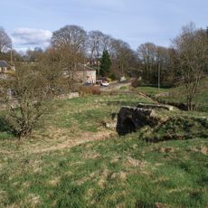
Footbridge Over Middleton Burn 60 Metres South-West Of Congregational Church
49 m
Roadside Wall To South And South-West Of The Garden House
2.6 km
Privy House 25 Metres To North-West Of Owl House
2.8 km
Highlaws Farmhouse
1.8 km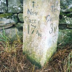
Milepost On West Side Of Road Opposite Track To Corridge
2.1 km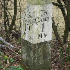
Milestone On South Side Of Road At Ngr Nz 03628419
2.7 km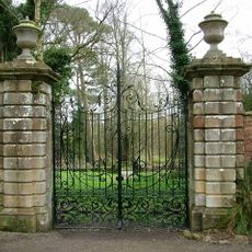
Walled Garden With Gateways
2.7 km
Standing stone, 700m south west of Middleton South
2.7 km
Sundial In Walled Garden 100 Metres South-East Of Owl House
2.8 km
Huckhoe palisaded enclosure, defended settlement and Romano-British settlement, 550m north east of Bolam West Houses
2.6 km
Middleton Mill And Millers House
859 m
The Chapel, Farmbuilding 70 Metres South-West Of Corridge Farmhouse
1.6 km
Range Of Farmbuildings South-West Of Hartburn Grange Farmhouse
1.6 km
Farmbuildings To West Of Marlish Farmhouse
1.7 km
Stone Walls Associated With Farm Buildings
1.6 km
The Garden House
2.7 km
Garden Wall And Dovecote/Privy To East Of Corridge Farmhouse
1.6 km
The Owl House On North Side Of Walled Garden
2.8 km
Outbuildings And Yard Walls To North Of The Garden House
2.7 km
Eastern Cottage Adjacent To Manse
33 mReviews
Visited this place? Tap the stars to rate it and share your experience / photos with the community! Try now! You can cancel it anytime.
Discover hidden gems everywhere you go!
From secret cafés to breathtaking viewpoints, skip the crowded tourist spots and find places that match your style. Our app makes it easy with voice search, smart filtering, route optimization, and insider tips from travelers worldwide. Download now for the complete mobile experience.

A unique approach to discovering new places❞
— Le Figaro
All the places worth exploring❞
— France Info
A tailor-made excursion in just a few clicks❞
— 20 Minutes