The Middle Stead, architectural structure in Wallington Demesne, Northumberland, UK
Location: Wallington Demesne
GPS coordinates: 55.16477,-1.96049
Latest update: November 20, 2025 07:30

Holy Trinity Church
152 m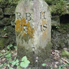
Milestone 50 Metres North Of Gate To Wallington Car Park
1.1 km
Outhouse Row To East Of Nos 1-3
14 m
Wall And Privy Houses 40 Metres South-East Of Post Office
95 m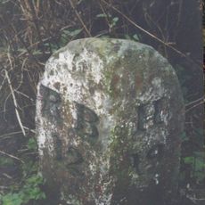
Milestone 160 Metres North Of Cambo School
460 m
Cartshed, Yard Walls And Attached Structures To Rear Of No 1
56 m
The Two Queens
48 m
No. 10 (Cambo House) And Cambo House Cottage
42 m
The Old Byre, Outbuilding North-West Of No. 9
31 m
The Arches
918 m
Farm Buildings To West Of Prior's Hall Farmhouse
784 m
2-5, Front Row
36 m
7-9, Front Row
10 m
Village Hall And Adjacent House
70 m
Houses To East Of Post Office
86 m
Trevelyan Graves 9 Metres East Of South Churchyard Gate
118 m
Smithy Adjacent To West End
88 m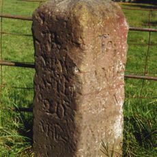
Milestone 40 Metres North Of Crossroads
658 m
Gate Piers And Gate To Churchyard With Adjacent Walls
95 m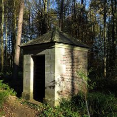
Sir Walter's Privy In East Wood
1.2 km
Priors Hall Farmhouse
786 m
1-3, Middle Row
32 m
Post Office
74 m
Drinking Fountain 40 Metres East Of Post Office
49 m
West House And West End
113 m
Cambo War Memorial
113 m
Garden Walls To South Of Prior's Hall Farmhouse
795 m
Bolt Cottage And Outbuilding To North
1.1 kmReviews
Visited this place? Tap the stars to rate it and share your experience / photos with the community! Try now! You can cancel it anytime.
Discover hidden gems everywhere you go!
From secret cafés to breathtaking viewpoints, skip the crowded tourist spots and find places that match your style. Our app makes it easy with voice search, smart filtering, route optimization, and insider tips from travelers worldwide. Download now for the complete mobile experience.

A unique approach to discovering new places❞
— Le Figaro
All the places worth exploring❞
— France Info
A tailor-made excursion in just a few clicks❞
— 20 Minutes