
28, Main Road, building in Christian Malford, Wiltshire, UK
Location: Christian Malford
GPS coordinates: 51.51471,-2.04246
Latest update: November 15, 2025 22:16
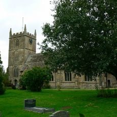
Church of All Saints
1.6 km
United Reformed Church
1.4 km
The Mermaid Inn
1 km
Three Hull Family Monuments In Churchyard, North Of North Porch Of All Saints Church
1.6 km
A Gale Monument In Churchyard In Angle Between South Aisle And Chancel Of All Saints Church
1.6 km
Dodford Farmhouse
1.3 km
The Red House
1 km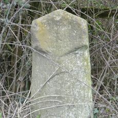
Milestone About 100 Metres South-West Of Drive To Swallett Farm
977 m
Swallett Farmhouse
1.1 km
Malford House
1.5 km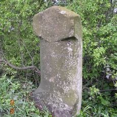
Milestone About 100 Metres East Of Townsends Garage
578 m
The Comedy
151 m
Village Cross
1 km
Beanhill Farmhouse
260 m
35 And 36, Main Road
454 m
The Anchorage Wayside
1 km
Hopkins And Newman Monuments In Churchyard, About 6 Metres East Of South Aisle Of All Saints Church
1.6 km
M Hull Monument In Churchyard About 3 Metres North Of Chancel Of All Saints Church
1.6 km
Dauntsey Road Bridge
1.1 km
Bridge Near Dauntsey (MLN1/88 30)
1.4 km
The Old Rectory
1.5 km
Three Fry Monuments In Churchyard East Of Chancel Of All Saints Church
1.6 km
Thornend Farmhouse
1.1 km
The Old Malt House
1.1 km
Swallett House
1.1 km
Apple Tree Cottage
994 m
Christian Malford War Memorial Cross
1.1 km
M Hopkins Monument In Churchyard About 10 Metres South East Of Aisle Of All Saints Church
1.6 kmReviews
Visited this place? Tap the stars to rate it and share your experience / photos with the community! Try now! You can cancel it anytime.
Discover hidden gems everywhere you go!
From secret cafés to breathtaking viewpoints, skip the crowded tourist spots and find places that match your style. Our app makes it easy with voice search, smart filtering, route optimization, and insider tips from travelers worldwide. Download now for the complete mobile experience.

A unique approach to discovering new places❞
— Le Figaro
All the places worth exploring❞
— France Info
A tailor-made excursion in just a few clicks❞
— 20 Minutes