Garden Wall At The Cedars, wall in Tonbridge and Malling, Kent, UK
Location: Tonbridge and Malling
GPS coordinates: 51.19763,0.27742
Latest update: November 21, 2025 07:37
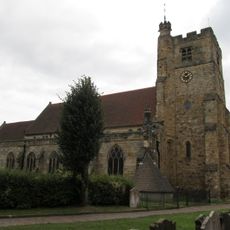
Church of St Peter and St Paul
44 m
6-11, Church Street
59 m
Church House (Ymca)
83 m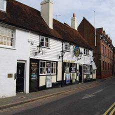
The Man Of Kent Public House
131 m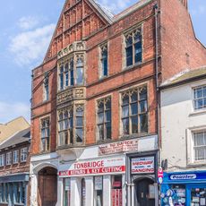
145 And 147, High Street
131 m
Minerva House Minerva House Annexe
129 m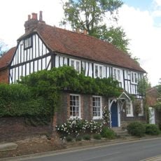
The Hermitage
87 m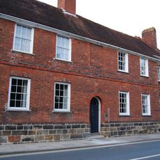
The Red House
112 m
139, High Street
134 m
157, High Street
125 m
161, High Street
127 m
175-195, High Street
144 m
The Priory
121 m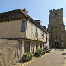
Tyger's Head
94 m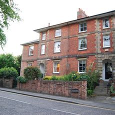
15, Bordyke
77 m
The Port Reeve's House
105 m
The Cedars
59 m
12, Bordyke
89 m
151-153, High Street
127 m
Bordyke House
105 m
13 And 14, Bordyke
87 m
7 And 8, Bordyke
149 m
Lions, Including Attached Garden Wall To East
132 m
1-5, Church Street
70 m
4-12, East Street
138 m
167-173, High Street
132 m
Outbuilding Opposite The Rose And Crown Tap
82 m
163, High Street
128 mReviews
Visited this place? Tap the stars to rate it and share your experience / photos with the community! Try now! You can cancel it anytime.
Discover hidden gems everywhere you go!
From secret cafés to breathtaking viewpoints, skip the crowded tourist spots and find places that match your style. Our app makes it easy with voice search, smart filtering, route optimization, and insider tips from travelers worldwide. Download now for the complete mobile experience.

A unique approach to discovering new places❞
— Le Figaro
All the places worth exploring❞
— France Info
A tailor-made excursion in just a few clicks❞
— 20 Minutes