28 and 29, Church Hill, building in The City of Brighton and Hove, West Sussex, UK
Location: Brighton and Hove
GPS coordinates: 50.86585,-0.15158
Latest update: November 20, 2025 12:28
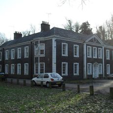
Patcham Place
149 m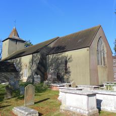
All Saints Church, Patcham
103 m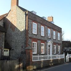
Southdown House
241 m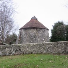
Dovecote at Patcham Court Farm, 80m north west of All Saints Church
139 m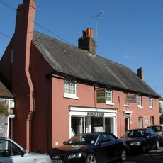
106 And 108, Old London Road
214 m
Lamp Post Approx 2 Metres West Of Number 57
185 m
110 And 112, Old London Road
197 m
19 And 20, The Square
122 m
Lamp post
136 m
Patcham Court Farmhouse
161 m
South West Stable Block To Patcham Place
171 m
Garden Wall To Southdown House
214 m
Lamp post opposite Number 51, Old London Road
234 m
53, 55 And 57, Old London Road
201 m
10, 11 And 12, The Square
139 m
8 And 9, The Square
149 m
13-18, The Square
124 m
124 And 126, Old London Road
161 m
128-136, Old London Road
151 m
4, 4A and 5, Church Hill
108 m
10, Church Hill
50 m
13-21, Church Hill
62 m
22 and 22A, Church Hill
36 m
23 and 24, Church Hill
22 m
33-36, Church Hill
30 m
Tombs In The Churchyard Of All Saints Church
114 m
Walls Between The Entrance To The Churchyard And The Village Barn (Not Included)
89 m
Walls To Patcham Court Farmhouse And The Dovecot
140 mReviews
Visited this place? Tap the stars to rate it and share your experience / photos with the community! Try now! You can cancel it anytime.
Discover hidden gems everywhere you go!
From secret cafés to breathtaking viewpoints, skip the crowded tourist spots and find places that match your style. Our app makes it easy with voice search, smart filtering, route optimization, and insider tips from travelers worldwide. Download now for the complete mobile experience.

A unique approach to discovering new places❞
— Le Figaro
All the places worth exploring❞
— France Info
A tailor-made excursion in just a few clicks❞
— 20 Minutes