
Former oasthouse about 12 metres east south east of Boughton Place
Former oasthouse about 12 metres east south east of Boughton Place, oast house in Boughton Malherbe, Kent, UK
Location: Boughton Malherbe
GPS coordinates: 51.21479,0.69387
Latest update: November 23, 2025 01:31
Chilston Park
1.3 km
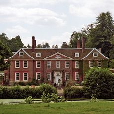
Boughton Place
47 m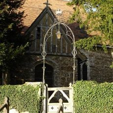
Church of St Nicholas
68 m
The Kings Head Public House
1.1 km
Lewsome Farmhouse
794 m
Cherry Tree Cottage Lavender Cottage Rosemary Cottage
1.2 km
Churchill Cottage
891 m
Ridding House
1.1 km
Stream Farmhouse
955 m
Plough House
908 m
Oast House At Tq 870 499
1.3 km
Marchant Farmhouse
1.3 km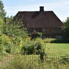
The Homestead
1.3 km
Oast House Circa 15 Yards North Of Elmstone Hole Farmhouse
1.3 km
24, 26, 28A And 28B, Lenham Road
1.2 km
Ivy House Farm
916 m
Liberton Hall and Liberton Cottage
1.1 km
Hazel Hill Cottage
1.3 km
1 and 2, Liverton Street
916 m
Elmstone Farmhouse
1.3 km
Dunromin Fermor Cottage Fermors Cottage
1.2 km
Elmstone Hole Farmhouse
1.3 km
Mansion Farmhouse
893 m
Bowley Cottage Bowley Hall Cottage
928 m
The Old Rectory
255 m
The Cottage
27 m
Former Coachman's cottages about 30 metres West of Chilston Park
1.3 km
Stables and Mounting Block about 30 metres North West of Chilston Park
1.3 kmReviews
Visited this place? Tap the stars to rate it and share your experience / photos with the community! Try now! You can cancel it anytime.
Discover hidden gems everywhere you go!
From secret cafés to breathtaking viewpoints, skip the crowded tourist spots and find places that match your style. Our app makes it easy with voice search, smart filtering, route optimization, and insider tips from travelers worldwide. Download now for the complete mobile experience.

A unique approach to discovering new places❞
— Le Figaro
All the places worth exploring❞
— France Info
A tailor-made excursion in just a few clicks❞
— 20 Minutes