79, The Drive, building in The City of Brighton and Hove, West Sussex, UK
Location: Brighton and Hove
GPS coordinates: 50.83239,-0.16767
Latest update: November 22, 2025 01:08
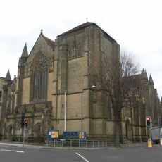
All Saints Church, Hove
234 m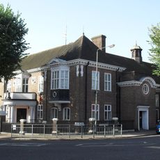
Ralli Hall
291 m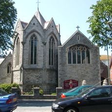
Church of the Sacred Heart, Hove
368 m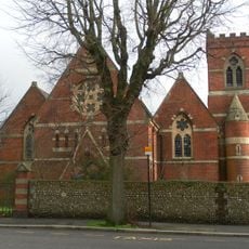
Holy Trinity Church, Hove
325 m
All Saints Vicarage
261 m
No 14 Including Front Area Garden Walls
70 m
44, Wilbury Road
248 m
Walls Enclosing Churchyard Of Holy Trinity Church
308 m
67, The Drive
93 m
No 71 Including Gatepiers
62 m
75, The Drive
31 m
No 77 Including Gatepiers And Railings
16 m
No 60 Including Walls Fronting Road
151 m
Nos 2-36 And Attached Railings And Walls
182 m
55, The Drive
192 m
51 And 53, The Drive
215 m
Eaton House Including Walls And Railings
274 m
3, Eaton Gardens
189 m
Nos 18 And 18A Including Walls And Railings
267 m
No 8 Including Walls And Gate
134 m
73, The Drive
47 m
Garden Wall And Gatepiers To All Saints Vicarage
284 m
52 And 54, The Drive
199 m
56, The Drive
183 m
58, The Drive
168 m
Nos 63 And 65 Including Walls And Gatepiers
110 m
No 69 Including Gatepiers
78 m
57, The Drive
171 mReviews
Visited this place? Tap the stars to rate it and share your experience / photos with the community! Try now! You can cancel it anytime.
Discover hidden gems everywhere you go!
From secret cafés to breathtaking viewpoints, skip the crowded tourist spots and find places that match your style. Our app makes it easy with voice search, smart filtering, route optimization, and insider tips from travelers worldwide. Download now for the complete mobile experience.

A unique approach to discovering new places❞
— Le Figaro
All the places worth exploring❞
— France Info
A tailor-made excursion in just a few clicks❞
— 20 Minutes