Table Tomb 6 Metres West Of Church, tomb in Froxfield, East Hampshire, Hampshire, UK
Location: Froxfield and Privett
GPS coordinates: 51.02477,-0.99777
Latest update: November 22, 2025 14:27
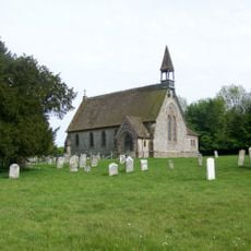
Church of St Peter on the Green
18 m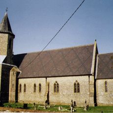
Church of St Peter
1.3 km
Table Tomb 4 Metres South Of Church
21 m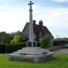
Froxfield War Memorial
48 m
Bordean House
1.2 km
Farm Buildings 60 Metres South Of Upper Bordean House
1.5 km
Two barrows immediately north east of Lower Bordean Farm
1.3 km
Lower Bordean Farmhouse
1.4 km
Guiles
80 m
Pound House
66 m
Bydean Farmhouse
820 m
Upper Bordean House
1.4 km
Roman earthworks on Stoner Hill, Ridge Hanger
1.3 km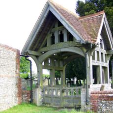
Lychgate 20M North Of The Church Of St Peter On The Green
39 m
Bowl barrow immediately north of Bordean House
1.1 km
Love's Charity
129 m
Bowl barrow 100m south east of Lower Bordean Farm
1.3 km
Trees Cottage
585 m
Holly Lodge
132 m
Table Tomb 20 Metres North East Of Church
39 m
Table Tomb 14 Metres North Of Church
25 m
King's Cottage
1.4 km
Ridge Farmhouse
1.1 km
Table Tomb 4 Metres North Of Church
20 m
Bower Farmhouse
1.2 km
Headstone To John Baker, 12M North Of The Church Of St Peter On The Green
25 m
K6 Telephone Kiosk
47 m
Froxfield entrenchments
189 mReviews
Visited this place? Tap the stars to rate it and share your experience / photos with the community! Try now! You can cancel it anytime.
Discover hidden gems everywhere you go!
From secret cafés to breathtaking viewpoints, skip the crowded tourist spots and find places that match your style. Our app makes it easy with voice search, smart filtering, route optimization, and insider tips from travelers worldwide. Download now for the complete mobile experience.

A unique approach to discovering new places❞
— Le Figaro
All the places worth exploring❞
— France Info
A tailor-made excursion in just a few clicks❞
— 20 Minutes