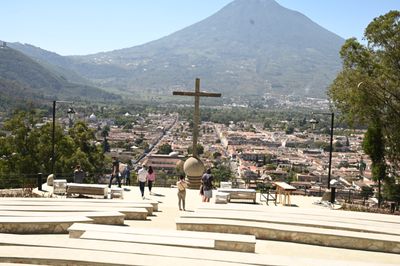
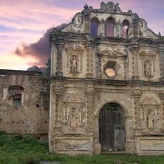
Cerro de la Cruz, Antigua Guatemala, Hilltop viewpoint in Antigua, Guatemala.
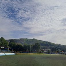
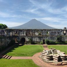
Cerro de la Cruz is a hilltop accessed by stone stairs and pathways leading to a large cement cross overlooking the colonial city below. The site offers sweeping views of three volcanoes that form the southern horizon beyond Antigua's rooftops and historic buildings.
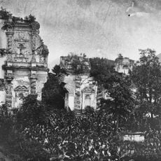
The site became a point of reference for people entering the colonial city since Antigua's earliest days. The cement cross that stands today was installed in 1930, replacing an older wooden structure that had marked this location for generations.
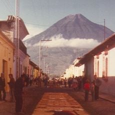
Locals arrive during Ascension Thursday to gather at the summit for spiritual reflection and community connection. The site serves as a meaningful place where residents and visitors alike experience the religious traditions held dear by the city's people.
The hilltop can be reached during daylight hours and is regularly patrolled to ensure visitor safety along the paths and stairs. Wear sturdy shoes with good grip, as the stone steps are steep and can become slippery when wet or in humid conditions.
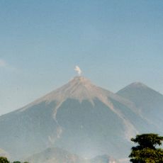
From this vantage point on clear days, three volcanoes rise distinctly to the south in a formation rarely seen from other places in the region. Many visitors miss that the light is most favorable for photography in early morning hours when the volcanoes stand out sharply against the sky.
Inception: 1930
GPS coordinates: 14.56453,-90.73173
Latest update: December 6, 2025 16:03
Guatemala offers photographers a mix of pre-Columbian sites, volcanic landscapes, and colonial buildings. The geography ranges from highland towns to rainforests and coastal areas along the Pacific and Caribbean. Ancient Maya temples stand alongside Spanish-era churches, while indigenous markets and traditional villages show cultural life. The landscape is marked by active and dormant volcanoes, often surrounded by coffee plantations. Places like Antigua Guatemala display colonial architecture with cobblestone streets and courtyards. Lake Atitlán sits between mountains and smaller communities. Tikal and other archaeological sites in the north preserve Maya structures within jungle settings. Chichicastenango Market is known for woven textiles and incense. Pacaya and Acatenango are accessible volcanoes, while Semuc Champey offers natural pools in a limestone forest. The variety of regions makes Guatemala a country with different perspectives in short distances.
Volcán de Agua
11 km
Acatenango
16.9 km
La Merced Church
425 m
Antigua Guatemala Cathedral
884 m
Santa Catalina Arch
606 m
Church and Convent of Capuchins
539 m
Palacio de los Capitanes Generales
975 m
Ayuntamiento of Antigua Guatemala
803 m
Chimaltenango Central Park
14.3 km
Iglesia de Nuestra Señora del Carmen
897 m
Church and Convent of Society of Jesus
886 m
College of the Company of Jesus
836 m
La Recolección Architectural Complex
1.1 km
Hermano Pedro's Hospital
1.1 km
Candelaria Parrish
534 m
El Calvario Church
2.2 km
Parroquia de San Sebastián
497 m
Casa Popenoe
956 m
Ermita de Santa Isabel de Hungría
2.3 km
Estadio Municipal de Bárcena
12.8 km
Café de la Escalonia
1.7 km
Ermita de San Jerónimo
868 m
Royal Palace of the Captains General
953 m
Parque Molino De Las Flores 1
17 km
Templo Santa Teresa De Jesus
466 m
MUNAG - Museo Nacional de Arte de Guatemala
955 m
Bosque Las Hojarascas
14 km
Hobbitenango
4.5 kmReviews
Visited this place? Tap the stars to rate it and share your experience / photos with the community! Try now! You can cancel it anytime.
Discover hidden gems everywhere you go!
From secret cafés to breathtaking viewpoints, skip the crowded tourist spots and find places that match your style. Our app makes it easy with voice search, smart filtering, route optimization, and insider tips from travelers worldwide. Download now for the complete mobile experience.
A unique approach to discovering new places❞
— Le Figaro
All the places worth exploring❞
— France Info
A tailor-made excursion in just a few clicks❞
— 20 Minutes