Golf Club Touraine
Location: Gatineau
Address: Chemin Taché
GPS coordinates: 45.51905,-75.73054
Latest update: December 3, 2025 06:36

Collège Saint-Alexandre
3.3 km
Parc de la Sucrerie
2.5 km
Parc de Trigance
3 km
Parc de Lotbinière
2.7 km
Parc de la Riviera
5 km
Parc des Ravins-Boisés
4.8 km
Parc Émard
2 km
Parc de Laperrière
527 m
Parc de Castillou
3.6 km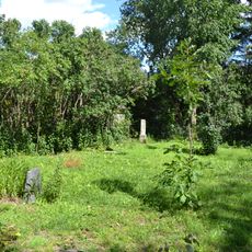
Barber Family Cemetery
3 km
Parc de l'Oiseau-Bleu
4.7 km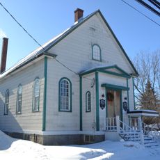
Chelsea United Church
4.4 km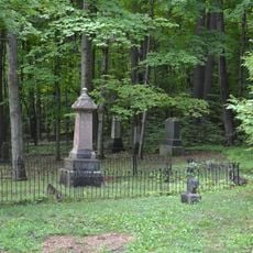
Cimetière des Pionniers de Chelsea
4.9 km
Parc du Saint-Coeur-de-Marie
4.4 km
Parc de Tellier
4.2 km
Parc du Dôme
5.4 km
Parc Marcel-Gladu
4.2 km
Parc de Sainte-Maxime
3.6 km
Parc Le Roy
2.7 km
Rapides Farmer
3.6 km
Pont Alonzo-Wright
3.9 km
Pont Fleury
5 km
Galaxy Blues Observatory
4.8 km
Club de Golf Hautes Plaines
5.3 km
Marais de Touraine
2.9 km
Scenic viewpoint
5.1 km
Waterfall
2.3 km
Ford, waterfall
1.7 kmReviews
Visited this place? Tap the stars to rate it and share your experience / photos with the community! Try now! You can cancel it anytime.
Discover hidden gems everywhere you go!
From secret cafés to breathtaking viewpoints, skip the crowded tourist spots and find places that match your style. Our app makes it easy with voice search, smart filtering, route optimization, and insider tips from travelers worldwide. Download now for the complete mobile experience.

A unique approach to discovering new places❞
— Le Figaro
All the places worth exploring❞
— France Info
A tailor-made excursion in just a few clicks❞
— 20 Minutes