Wild- und Wanderpark Weiskirchen
Location: Rappweiler
Location: Weiskirchen
Operator: Gemeinde Weiskirchen
GPS coordinates: 49.56459,6.77364
Latest update: November 20, 2025 01:08

Holzbachtal
1.1 km
Wachtelkopf bei Rappweiler
2.8 km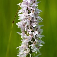
Wachtelkopf bei Rappweiler
2.6 km
Wald von Saarschleife ueber Mettlach bis Steinberg und Lösterwald östlich Wadrill
376 m
NSG 'Holzbachtal'
1.1 km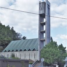
St. Medardus (Waldhölzbach)
1.7 km
Soldatendenkmal der zwei Weltkriege
1.7 km
Catholic church building, wayside cross, Christianity
2.1 km
Teufelsfels
1.7 km
Scenic viewpoint
461 m
Scenic viewpoint
1.7 km
Schöne Aussicht
2.1 km
Scenic viewpoint
2.5 km
Wayside cross, Christianity
2.5 km
Wildfreigehege Rappweiler
516 m
Catholic church building, wayside cross, Christianity
2 km
Christianity, Catholic church building, wayside cross
1.9 km
Wildgehege
501 m
Wayside cross, Christianity, Catholic church building
1.1 km
Catholic church building, wayside cross, Christianity
1.4 km
Mariengrotte
1.7 km
Mariengrotte
2.7 km
Memorial stone, memorial
2.5 km
Commemorative plaque, memorial
2.5 km
Memorial
2.5 km
Memorial
2.5 km
Memorial, commemorative plaque
2.5 km
Memorial stone, memorial
2.5 kmReviews
Visited this place? Tap the stars to rate it and share your experience / photos with the community! Try now! You can cancel it anytime.
Discover hidden gems everywhere you go!
From secret cafés to breathtaking viewpoints, skip the crowded tourist spots and find places that match your style. Our app makes it easy with voice search, smart filtering, route optimization, and insider tips from travelers worldwide. Download now for the complete mobile experience.

A unique approach to discovering new places❞
— Le Figaro
All the places worth exploring❞
— France Info
A tailor-made excursion in just a few clicks❞
— 20 Minutes