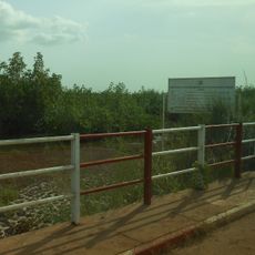
Puit El Hadji Tall
Location: Communauté rurale de Diembéring
GPS coordinates: 12.47479,-16.77874
Latest update: November 20, 2025 11:11

Cacheu Mangroves Natural Park
68 km
Memorial da Escravatura e do Tráfico Negreiro
70.1 km
Forte de Cacheu
70 km
Kalissaye Avifaunal Reserve
21.6 km
Praia das Vacas
51 km
Way to cashew plantation
25.5 km
The King
25.9 km
Port Karron
47.2 km
Bird Island
43.3 km
Carneval location
50.5 km
Kapok bantang woro
58.3 km
Jardin botanique Satang Diabang
50.2 km
Jardin Télampa
51.7 km
Marihuana farm
38.8 km
1
57.7 km
Chez George massage
12.5 km
2
57.8 km
Plateforme d'observation - Arbre fromager
25.7 km
Tesito Beach
69.2 km
Tour d'observation des Lamantins
29.7 km
Scenic viewpoint
56.4 km
Pirogue Harbour
56.3 km
Fortaleza Português de Cacheu
70 km
Monument
54.6 km
Memorial
56.7 km
Bignona
69.6 km
La tombe di Captaine Aristide Protet
12.2 km
École Professionnelle Spéciale
12.8 kmReviews
Visited this place? Tap the stars to rate it and share your experience / photos with the community! Try now! You can cancel it anytime.
Discover hidden gems everywhere you go!
From secret cafés to breathtaking viewpoints, skip the crowded tourist spots and find places that match your style. Our app makes it easy with voice search, smart filtering, route optimization, and insider tips from travelers worldwide. Download now for the complete mobile experience.

A unique approach to discovering new places❞
— Le Figaro
All the places worth exploring❞
— France Info
A tailor-made excursion in just a few clicks❞
— 20 Minutes