A Pa Chải
Location: Huyện Mường Nhé
GPS coordinates: 22.40402,102.16476
Latest update: November 14, 2025 14:11
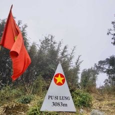
Phu Si Lung
68.7 km
Phou Den Din National Protected Area
56.9 km
Gelantan Dam
35 km
Jufudu Dam
68.6 km
Tukahe Dam
24.6 km
整董傣族传统民居建筑群
68.3 km
Phou Den Dinh (tumoy sa bukid sa Laos)
35.5 km
Phou Ya Ho Yèn
13.8 km
Phou Nam Khé
46.5 km
San Cho Kay
12.4 km
Y Ma Ho (tumoy sa bukid sa Laos)
8.5 km
江城哈尼族彝族自治县博物馆
36.2 km
Phou Phyao
54.7 km
Cung văn hoá thiếu nhi
66.1 km
To stupa take right way
51.7 km
Hòn đá Trắng
41.9 km
Work of art
36.2 km
Work of art
35.3 km
Sculpture, Work of art
68 km
Way to stupa
50.7 km
Phu Si
66.1 km
Joezeff Stallone pass 1312m
50.2 km
ຂວານລາສານ Khoan La San 十层大山
2.2 km
大庙遗址
69.3 km
Tổ quốc ghi công
38.1 km
Đài tưởng niệm anh hùng liệt sĩ
19.3 km
Monument
66.2 km
Waterfall
36.3 kmReviews
Visited this place? Tap the stars to rate it and share your experience / photos with the community! Try now! You can cancel it anytime.
Discover hidden gems everywhere you go!
From secret cafés to breathtaking viewpoints, skip the crowded tourist spots and find places that match your style. Our app makes it easy with voice search, smart filtering, route optimization, and insider tips from travelers worldwide. Download now for the complete mobile experience.

A unique approach to discovering new places❞
— Le Figaro
All the places worth exploring❞
— France Info
A tailor-made excursion in just a few clicks❞
— 20 Minutes