ཕག་མོ་རི།
Location: 雅江县 ཉག་ཆུ་རྫོང།
GPS coordinates: 30.10190,101.19008
Latest update: November 12, 2025 22:07

冷古寺
41.6 km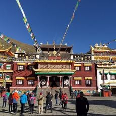
Tagong Temple
40.1 km
天路十八弯观景台
32.8 km
360°八郎观景台
36.4 km
ཕག་མོ་རི། 帕姆岭山
552 m
罗布岭
127 m
高尔寺方向
27.6 km
黑石城
23 km
Horse riding
40.6 km
车
36.3 km
Tibet letters
40.1 km
318国道
32.3 km
Oṃ maṇi padme hūṃ hrīḥ
29.5 km
Scenic viewpoint
41 km
Valley of 10,000 mani stones
38.5 km
Valley of painted stones
37.4 km
十里长廊开始
28.4 km
Scenic viewpoint
39.7 km
Scenic viewpoint
40 km
贡嘎山 雅拉
22 km
黑石城
25 km
十里长廊尾声
37 km
Scenic viewpoint
40.4 km
玛尔可垭口
28.2 km
熊宗卡观景台
37 km
居里寺垭口观景平台
34.2 km
剪子湾山观景台
35.9 km
黑石城
20.6 kmReviews
Visited this place? Tap the stars to rate it and share your experience / photos with the community! Try now! You can cancel it anytime.
Discover hidden gems everywhere you go!
From secret cafés to breathtaking viewpoints, skip the crowded tourist spots and find places that match your style. Our app makes it easy with voice search, smart filtering, route optimization, and insider tips from travelers worldwide. Download now for the complete mobile experience.

A unique approach to discovering new places❞
— Le Figaro
All the places worth exploring❞
— France Info
A tailor-made excursion in just a few clicks❞
— 20 Minutes