格西草原
Location: 康定市 དར་མདོ་གྲོང་ཁྱེར།
GPS coordinates: 29.88086,101.91897
Latest update: November 11, 2025 23:11
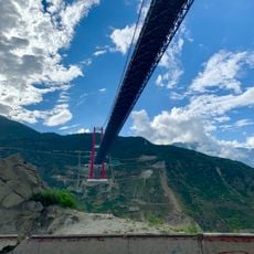
Luding Yaye Expressway Bridge
30.1 km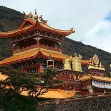
Nanwu Si Monastery
18.2 km
Scenic viewpoint
17 km
Scenic viewpoint
29.2 km
亚拢沟钙化滩
24.1 km
红军飞夺泸定桥纪念碑
30 km
康定市第二中学
10.3 km
Sculpture, Work of art
19.4 km
折多山观雪台
24.2 km
雅哈垭口
24.4 km
Viewpoint
13.2 km
Viewpoint
24.6 km
Scenic viewpoint
29.3 km
雅家情海
10.7 km
Dancing Square
19.7 km
Buddha flags
16.9 km
Scenic viewpoint
17.1 km
Scenic viewpoint
12.7 km
Scenic viewpoint
12.6 km
Scenic viewpoint
19.4 km
Scenic viewpoint
12.6 km
Scenic viewpoint
15.4 km
Scenic viewpoint
12.6 km
玉顶积雪观景台
13.6 km
Scenic viewpoint
12.6 km
木弄垭口
21.5 km
Vehicle
30 km
Tank
29.9 kmReviews
Visited this place? Tap the stars to rate it and share your experience / photos with the community! Try now! You can cancel it anytime.
Discover hidden gems everywhere you go!
From secret cafés to breathtaking viewpoints, skip the crowded tourist spots and find places that match your style. Our app makes it easy with voice search, smart filtering, route optimization, and insider tips from travelers worldwide. Download now for the complete mobile experience.

A unique approach to discovering new places❞
— Le Figaro
All the places worth exploring❞
— France Info
A tailor-made excursion in just a few clicks❞
— 20 Minutes