מצוק נחל בוקר
Location: מועצה אזורית רמת נגב
Website: https://27crags.com/crags/nahal-boker
GPS coordinates: 30.91595,34.79977
Latest update: October 15, 2025 21:42
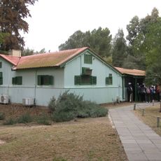
Ben Gurion's Desert Home
4.8 km
חורבת הרועה
5.2 km
Mt. Zaror
6.5 km
פרגולה וזולה שצופה למדבר
4.4 km
Me‘arat Ashalim
6.6 km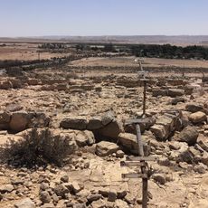
נוף מרהיב לכוון קיבוץ שדה בוקר ובקעת צין
3.9 km
Shemurat H̱elmonit Rekhes Boqer
3.6 km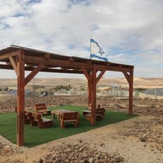
מצפה יהונתן
4.4 km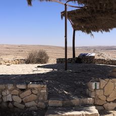
Hagai Viewpoint
3.2 km
H̱orbat Ritma
3 km
העיר האבודה
3.9 km
Archaeological site
5.6 km
Ruins
3.3 km
מצד חלוקים
3.1 km
Archaeological site
3 km
מגדל נבטי
2.9 km
מבנה נבטי - מגדל שמירה
4.8 km
חרבת רתמה
2.9 km
מצודת נחל בוקר
2.7 km
חורבת חצצה
3.4 km
מאגורה
5.7 km
מצודת הר בוקר
5.8 km
מגדל שמירה נבטי
6.1 km
עמרי חיים אלמקייס
2.5 km
שפפי
2.2 km
איתי מינץ
6.9 km
Waterfall
6.9 km
Waterfall
7 kmReviews
Visited this place? Tap the stars to rate it and share your experience / photos with the community! Try now! You can cancel it anytime.
Discover hidden gems everywhere you go!
From secret cafés to breathtaking viewpoints, skip the crowded tourist spots and find places that match your style. Our app makes it easy with voice search, smart filtering, route optimization, and insider tips from travelers worldwide. Download now for the complete mobile experience.

A unique approach to discovering new places❞
— Le Figaro
All the places worth exploring❞
— France Info
A tailor-made excursion in just a few clicks❞
— 20 Minutes