Rocks garden
Location: あきる野市
Accessibility: Niedostępne dla wózków inwalidzkich
GPS coordinates: 35.77630,139.14344
Latest update: November 15, 2025 22:03
Mount Mitake
908 m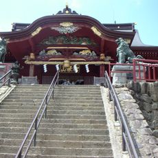
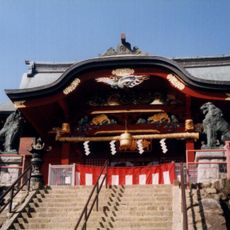
Musashi Mitake Shrine
938 m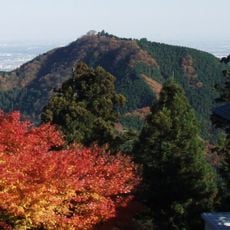
Mount Hinode
2.2 km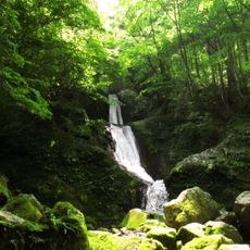
Mitsugama Falls
1.4 km
長尾平展望台
909 m
御岳平
1.8 km
Tengu-No-Koshikake Cedar
414 m
Statue of Hatakeyama Shigetada
958 m
Scenic viewpoint
405 m
Scenic viewpoint
1.8 km
Scenic viewpoint
1.7 km
大岳山 観測所
897 m
Scenic viewpoint
510 m
Scenic viewpoint
1.7 km
地蔵・供養塔群
3.1 km
地蔵・供養塔群
2.9 km
御嶽山道供養塔
2.7 km
長谷川恒男
874 m
Memorial
1.7 km
神山霊土歌碑
933 m
大滝
1.6 km
ネジレの滝
1.4 km
大滝
1.3 km
綾広の滝
23 m
七代の滝
485 m
天狗滝
3.4 km
小滝
1.8 km
綾滝
2.9 kmReviews
Visited this place? Tap the stars to rate it and share your experience / photos with the community! Try now! You can cancel it anytime.
Discover hidden gems everywhere you go!
From secret cafés to breathtaking viewpoints, skip the crowded tourist spots and find places that match your style. Our app makes it easy with voice search, smart filtering, route optimization, and insider tips from travelers worldwide. Download now for the complete mobile experience.

A unique approach to discovering new places❞
— Le Figaro
All the places worth exploring❞
— France Info
A tailor-made excursion in just a few clicks❞
— 20 Minutes