
Momo-no-migotodani
Location: 大鹿村
Website: http://ooshika-kanko.com/nikki/2017/04/post-123.html
Website: http://ooshika-kanko.com/nikki/2017/04/post-123.html
GPS coordinates: 35.55475,138.04989
Latest update: October 10, 2024 22:54
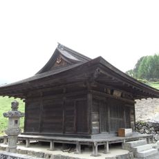
福徳寺
585 m
宗久寺跡
523 m
沢戸集落ビューポイント
60 m
Sawado Jizo
160 m
細久保道祖神
255 m
宗久寺の地蔵群
526 m
Memorial stone, memorial
391 m
Sawado Kannon Group
398 m
Memorial
413 m
香坂高宗の墓
424 m
Wayside shrine
426 m
Memorial, statue
472 m
3rd Kannon
508 m
細久保見晴舞台
137 m
沢戸石造群
78 m
Hananosawado
319 m
Memorial
537 m
Jamongan Serpentinit Outcrop (Median Tectonic Line)
549 m
Memorial stone, memorial
556 m
上市場の地蔵
579 m
○
581 m
Yakushi Nyorai and Amida Nyorai
583 m
福徳寺石造群
585 m
Nyorin Kannon
585 m
Stele, memorial
525 m
玉垣石灯籠
589 m
玉垣石灯籠
590 m
Keshohengan Schist Outcrop (Median Tectonic Line)
591 mReviews
Visited this place? Tap the stars to rate it and share your experience / photos with the community! Try now! You can cancel it anytime.
Discover hidden gems everywhere you go!
From secret cafés to breathtaking viewpoints, skip the crowded tourist spots and find places that match your style. Our app makes it easy with voice search, smart filtering, route optimization, and insider tips from travelers worldwide. Download now for the complete mobile experience.

A unique approach to discovering new places❞
— Le Figaro
All the places worth exploring❞
— France Info
A tailor-made excursion in just a few clicks❞
— 20 Minutes