Underground River
Location: Albay
Website: https://facebook.com/Quitinday-Underground-River-1153078468104690
GPS coordinates: 13.07626,123.60447
Latest update: October 28, 2025 16:06
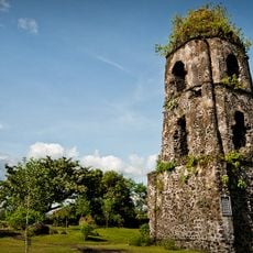
Cagsawa Ruins
14.5 km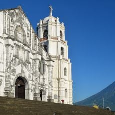
Daraga Church
14.3 km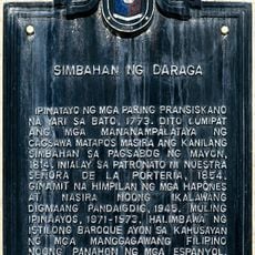
Church of Daraga historical marker
14.3 km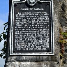
Church of Cagsaua historical marker
14.5 km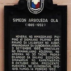
Simeon Arboleda Ola historical marker
12.7 km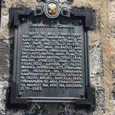
Church of Camalig historical marker
13 km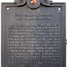
Bicol Regional Training and Teaching Hospital historical marker
15.2 km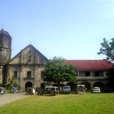
Camalig Church
13 km
Quituinan Hill Visitors Center
12.3 km
Highland's Park
14.3 km
Quitinday Greenhills
3.8 km
Solong Eco Park & Tours, Cave & Mountain
6.3 km
Ranchwood Garden Receptions
10.9 km
Quituinan Hills
12.3 km
Hoyop Hoyopan Cave
7.5 km
Sumlang Lake Eco Park
13.6 km
Farm Plate
13.6 km
Bagumbayan Gymnasium
14 km
FarmPlate
13.4 km
Torch of Wisdom
15.1 km
Scenic viewpoint
14.3 km
Quitinday Hills
2.9 km
Scenic viewpoint
3.1 km
Japanese Tunnel
12.3 km
Quitinday Underground River
490 m
Quitinday Hills
458 m
Funeraria De Angelito
9.2 km
BUCAF Manuel Roxas Monument
12.9 kmReviews
Visited this place? Tap the stars to rate it and share your experience / photos with the community! Try now! You can cancel it anytime.
Discover hidden gems everywhere you go!
From secret cafés to breathtaking viewpoints, skip the crowded tourist spots and find places that match your style. Our app makes it easy with voice search, smart filtering, route optimization, and insider tips from travelers worldwide. Download now for the complete mobile experience.

A unique approach to discovering new places❞
— Le Figaro
All the places worth exploring❞
— France Info
A tailor-made excursion in just a few clicks❞
— 20 Minutes