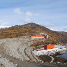
Бункер
Location: Хасынский муниципальный округ
GPS coordinates: 61.39494,151.77261
Latest update: November 3, 2025 14:43
Kolyma Reservoir
116 km
Вышка
999 m
Вышка
863 m
Вышка Скрубер
702 m
Пулеметная вышка
479 m
Бункер
1.4 km
Лагерь Сопка
138 km
Хетинские столбы
37.6 km
Scenic viewpoint
122.8 km
Scenic viewpoint
946 m
Scenic viewpoint
460 m
Марсово Поле
119.9 km
Scenic viewpoint
120.4 km
Scenic viewpoint
122.6 km
Scenic viewpoint
121.2 km
Руины СССР Мякит
16.9 km
Первостроителям Синегорья
101.1 km
Синегорье колымская ГЭС
102.7 km
В. В. Маяковскому
101.1 km
Memorial
97 km
День Победы
96.8 km
Татьяне Маландиной
96.7 km
Memorial
117.5 km
Memorial
117.9 km
Водопад Анманнычан
101.2 km
Waterfall
52.9 km
Waterfall
49.9 km
Waterfall
48.6 kmReviews
Visited this place? Tap the stars to rate it and share your experience / photos with the community! Try now! You can cancel it anytime.
Discover hidden gems everywhere you go!
From secret cafés to breathtaking viewpoints, skip the crowded tourist spots and find places that match your style. Our app makes it easy with voice search, smart filtering, route optimization, and insider tips from travelers worldwide. Download now for the complete mobile experience.

A unique approach to discovering new places❞
— Le Figaro
All the places worth exploring❞
— France Info
A tailor-made excursion in just a few clicks❞
— 20 Minutes