Противотанковые надолбы
Location: Сосновское сельское поселение
GPS coordinates: 60.52273,30.13909
Latest update: October 11, 2024 00:48
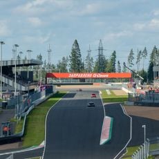
Igora Drive
3.2 km
Smorodinka River Valley
4.4 km
Вершина склонов Игоры
4.1 km
Bench, scenic viewpoint
4.3 km
Усадьба Маанселькя
2.9 km
А.М. Иванову
2.6 km
Peetamaki
3.4 km
Павшим в битве при Рауту красногвардейцам
3.4 km
Ruins
3.6 km
Русская деревня
3.7 km
Mini Zoo
4 km
Могила братьев Нахкури
4.1 km
Scenic viewpoint
4.1 km
Памятник
2 km
Лоси
4.3 km
Бывший хутор Вартио
2.9 km
Ruins, pillbox
4.4 km
Finnish school (1939)
2 km
Ruins, pillbox
4.5 km
Ruins, pillbox
4.5 km
Могила неизвестного солдата
4.6 km
ДОТ АПК (КаУР)
4.7 km
Scenic viewpoint
4.7 km
Братская могила
4.8 km
Н. Н. Зуевой
4.9 km
А. Синенко
4.9 km
Старый повротный круг
4.9 km
Фундамент
5.1 kmReviews
Visited this place? Tap the stars to rate it and share your experience / photos with the community! Try now! You can cancel it anytime.
Discover hidden gems everywhere you go!
From secret cafés to breathtaking viewpoints, skip the crowded tourist spots and find places that match your style. Our app makes it easy with voice search, smart filtering, route optimization, and insider tips from travelers worldwide. Download now for the complete mobile experience.

A unique approach to discovering new places❞
— Le Figaro
All the places worth exploring❞
— France Info
A tailor-made excursion in just a few clicks❞
— 20 Minutes