Развалины
Location: сельское поселение Гули
GPS coordinates: 42.81488,44.95382
Latest update: November 17, 2025 17:13
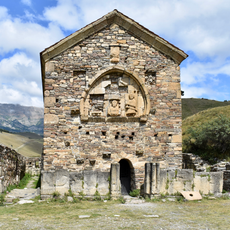
Tkhaba-Yerdy Church
1.4 km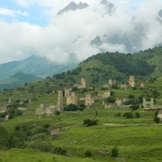
Jeyrakh-Assa museum-reserve
3.7 km
Alby-Yerdy Church
2.5 km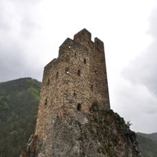
Башня боевая (Вовнушки)
3.7 km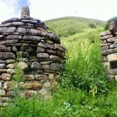
Склепы (девять) (Вовнушки)
3.9 km
Fortified tower, ruins, tower
1.1 km
Fortified tower, ruins, tower
1.9 km
Склеп Барах
2.4 km
Scenic viewpoint
3.5 km
Scenic viewpoint
5.2 km
Scenic viewpoint
3.4 km
Вид на башни и горы
1.4 km
Scenic viewpoint
2.6 km
Ruins, tower, fortified tower
3.7 km
Эгикхал
3.6 km
Ruins, tower, fortified tower
4.5 km
Вовнушки башни на скалах
3.7 km
Ruins
1.3 km
Ruins
1.3 km
Ruins of the old settlement
1.1 km
Fortified tower, ruins, tower
4.7 km
Tower, fortified tower, ruins
4.7 km
Ruins
3.9 km
Башенный комплекс Нижний Кхарт
6.2 km
Несколько башен и разваленные постройки.
4.3 km
Разв.
5.3 km
Разв.
5.3 km
Разв.
5.7 kmReviews
Visited this place? Tap the stars to rate it and share your experience / photos with the community! Try now! You can cancel it anytime.
Discover hidden gems everywhere you go!
From secret cafés to breathtaking viewpoints, skip the crowded tourist spots and find places that match your style. Our app makes it easy with voice search, smart filtering, route optimization, and insider tips from travelers worldwide. Download now for the complete mobile experience.

A unique approach to discovering new places❞
— Le Figaro
All the places worth exploring❞
— France Info
A tailor-made excursion in just a few clicks❞
— 20 Minutes