
Финский опорный пункт времён Зимней войны
Location: Красносельское сельское поселение
GPS coordinates: 60.53680,29.17281
Latest update: November 16, 2025 10:45
Mass Grave of Soviet Soldiers in Merkki
3.6 km
Плотина затопления укрепрайона Le
962 m
Артиллерийский дот (1941)
1.7 km
Опорный пункт времён Финской войны
648 m
Зубы дракона
3.5 km
Стрелковые позиции, траншеи
701 m
SJ11
4.7 km
Sj10
4.7 km
Финский "Блиндаж смерти"
5.4 km
Sj3
4.9 km
Memorial
1.6 km
Memorial
965 m
Le7
2.2 km
Le6
2.1 km
Воинское захоронение №4
2.5 km
Воинское захоронение №70
3.6 km
Ruins
4.7 km
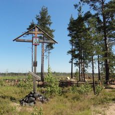
Памятный крест жертвам войн
1 km
Место захоронения солдата РККА
2.2 km
Могила неизвестного солдата
2.4 km
Le5
491 m
Le2 Дот одноамбразурный постройки 20х годов
82 m
Le1
23 m
Фундамент финского дома (хутор Ratavart)
590 m
Ратаварт
572 m
Воинское захоронение
2.6 km
Памятный знак на месте падения самолёта Як-9
4.2 km
Ruins
5 kmReviews
Visited this place? Tap the stars to rate it and share your experience / photos with the community! Try now! You can cancel it anytime.
Discover hidden gems everywhere you go!
From secret cafés to breathtaking viewpoints, skip the crowded tourist spots and find places that match your style. Our app makes it easy with voice search, smart filtering, route optimization, and insider tips from travelers worldwide. Download now for the complete mobile experience.

A unique approach to discovering new places❞
— Le Figaro
All the places worth exploring❞
— France Info
A tailor-made excursion in just a few clicks❞
— 20 Minutes