
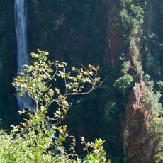
Namtokmasangnam forest park
Location: จังหวัดแม่ฮ่องสอน
GPS coordinates: 19.06509,97.99783
Latest update: November 15, 2025 06:45
Namtok Mae Surin National Park
9.2 km
Thung Bua Tong Forest Park
21.3 km
Pha Bong Viewpoint
11.9 km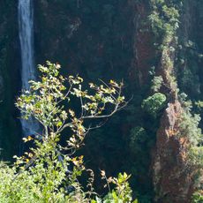
Mae Surin Falls
15.9 km
Wat Pha Bong Nuea
16.2 km
Wat Pha Bong Tai
15.2 km
Bamboo Bridge
16.1 km
Awesome view of the hills
9.6 km
Lake
9.1 km
Thung Bua Tong
21.4 km
Scenic viewpoint
20.5 km
Mae Surin Waterfall Viewpoint
15.7 km
Scenic viewpoint
18.9 km
ท่าเรือห้วยปูแกง
21.9 km
Pha Bong Waterfall - only in raining season
14.2 km
Sunset view point
15.6 km
Nice view, you can go with motorcycle
21.1 km
Mae Surin Waterfall Viewpoint
15.7 km
Starting point Mae Sakut Trail
21.1 km
Long Neck village - 250THB
23.7 km
Scenic viewpoint
21.2 km
Thung Bua Tong
20.8 km
Rice terraces viewpoint
18 km
พระบรมราชานุสาวรีย์สมเด็จพระนเรศวรมหาราช
21.9 km
Waterfall, tourist attraction
17.1 km
Waterfall 1 (Mae Sakut trail)
20.9 km
Waterfall
19.6 km
Waterfall 2 (Mae Sakut Nature Trail)
19.6 kmReviews
Visited this place? Tap the stars to rate it and share your experience / photos with the community! Try now! You can cancel it anytime.
Discover hidden gems everywhere you go!
From secret cafés to breathtaking viewpoints, skip the crowded tourist spots and find places that match your style. Our app makes it easy with voice search, smart filtering, route optimization, and insider tips from travelers worldwide. Download now for the complete mobile experience.

A unique approach to discovering new places❞
— Le Figaro
All the places worth exploring❞
— France Info
A tailor-made excursion in just a few clicks❞
— 20 Minutes