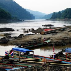
River crossing
Location: จังหวัดแม่ฮ่องสอน
GPS coordinates: 18.43933,97.69168
Latest update: November 15, 2025 12:02
Salawin National Park
39.4 km
Salawin Wildlife Sanctuary
26.2 km
Wat Chom Chaeng
40.8 km
Wat Si Bun Rueang
40.1 km
Wat Tha Kham Tai
37.6 km
Wat Thamma Chedi Wanaran
41.1 km
Wat Utthayarom
40 km
Wat Wohan Khun
27 km
Taungdangyi
21.8 km
Natee Rachan Waterfall
36.6 km
Scenic viewpoint
34.1 km
White Eye
41.4 km
Salawin National Park
36.8 km
Wat Sri Bunrueang
40.1 km
Wat Phrathat Chom Mon
37.1 km
Bridge
38.8 km
Om Long Canyon
37.8 km
Buddha statue
41.7 km
Wat Tham Phra
37 km
Don’t ever try to get through here without proper gear and trail bike
40 km
DeBuNoe Village
39.8 km
Scenic viewpoint
41.7 km
Phra That Jom Mom
37.1 km
Maelaluang Viewpoint
28.3 km
Scenic viewpoint
28.3 km
Yuam River Swimming Spot
37.3 km
Scenic viewpoint
31.6 km
Scenic viewpoint
32.3 kmReviews
Visited this place? Tap the stars to rate it and share your experience / photos with the community! Try now! You can cancel it anytime.
Discover hidden gems everywhere you go!
From secret cafés to breathtaking viewpoints, skip the crowded tourist spots and find places that match your style. Our app makes it easy with voice search, smart filtering, route optimization, and insider tips from travelers worldwide. Download now for the complete mobile experience.

A unique approach to discovering new places❞
— Le Figaro
All the places worth exploring❞
— France Info
A tailor-made excursion in just a few clicks❞
— 20 Minutes