
Very hard way up the mountain
Location: จังหวัดเชียงราย
GPS coordinates: 19.83509,100.02044
Latest update: November 15, 2025 10:32
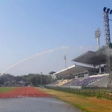
Chiangrai Province Stadium
19.4 km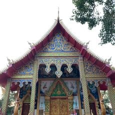
Wat Khao Kaeo Dap Phai
13 km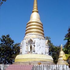
Wat Phra That Soi Thong
18.1 km
Wat Khiri Chai
17.9 km
Nam Tok Pha Tao
16.9 km
Nam Tok Huai Ban
18.4 km
Ang Kep Nam Huai Sak
15.8 km
Ang Kep Nam Mae Tak
5.2 km
Ang Kep Nam Huai Ngio
17.7 km
Nam Tok Tat Bon
19.4 km
Ang Kep Nam Huai Kang
11 km
Nam Tok Mae Sak
16.4 km
Santiburi Golf Club
12.9 km
Garden Of Reeds
19.2 km
Wiang Chiang Rung
13.2 km
Floating Market
11.5 km
Night Market
13.7 km
Rong Bia Floating Market
11.4 km
Doi Pha Chang Amazing karst formation
197 m
Santaburi Golf Course
12.8 km
Lanna & Asean Culture Plaza
18.9 km
Buddha statue
19.5 km
Buddha Lantham statue
19.5 km
King Mengrai statue
19.2 km
Buddha Hall
19.3 km
Scenic viewpoint
7.2 km
Monument
10.9 km
ไร่เชิญตะวัน
17.1 kmReviews
Visited this place? Tap the stars to rate it and share your experience / photos with the community! Try now! You can cancel it anytime.
Discover hidden gems everywhere you go!
From secret cafés to breathtaking viewpoints, skip the crowded tourist spots and find places that match your style. Our app makes it easy with voice search, smart filtering, route optimization, and insider tips from travelers worldwide. Download now for the complete mobile experience.

A unique approach to discovering new places❞
— Le Figaro
All the places worth exploring❞
— France Info
A tailor-made excursion in just a few clicks❞
— 20 Minutes