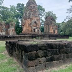
ศูนย์หัตถกรรมพื้นบ้านอำเภอนาโพธิ์
Location: จังหวัดบุรีรัมย์
GPS coordinates: 15.64527,102.95025
Latest update: November 17, 2025 05:14

Wat Hong
13.4 km
Wat Photharam
32.1 km
Wat Arun Phatthana
40.8 km
Wat Pracha Bamrung
30.6 km
Wat Sa Bua Kaeo
24.5 km
Prang Ku Suantang
15.5 km
Ang Kep Nam Huai Chiang Kham
39.7 km
Ang Kep Nam Phayanak
7.3 km
Ang Kep Nam Laloeng Wai
41.1 km
Ang Kep Nam Huai Chan Tai
45.7 km
Lam Takhong reservoir
49.3 km
Ang Kep Nam Nong Thung Noi
49.7 km
Ang Kep Nam Ban Khaen Dong
41.9 km
Wat Uthayawat
16.4 km
Ang Kep Nam Ek Sat Sunthon
43 km
Ang Kep Nam La Lueang Pen
37.6 km
Ang Kep Nam Ban Nong Mueang Yang
48.9 km
Ang Kep Nam Lam Pradok
38.1 km
Ang Kep Nam Huai Bong
45.9 km
Wat Matchim Wittayaram
43 km
Ku Santarat
34.8 km
Buddha
32.6 km
Prasat Ku Ban Daeng
45.5 km
กู่สันตรัตน์
34.7 km
Ku Noi
35.1 km
Airbus A330-300 (former HS-TEF)
42.8 km
Prasert yaemsri
45.1 km
Prang Ban Sida
42.5 kmReviews
Visited this place? Tap the stars to rate it and share your experience / photos with the community! Try now! You can cancel it anytime.
Discover hidden gems everywhere you go!
From secret cafés to breathtaking viewpoints, skip the crowded tourist spots and find places that match your style. Our app makes it easy with voice search, smart filtering, route optimization, and insider tips from travelers worldwide. Download now for the complete mobile experience.

A unique approach to discovering new places❞
— Le Figaro
All the places worth exploring❞
— France Info
A tailor-made excursion in just a few clicks❞
— 20 Minutes