Ngã ba Rình Rình nhánh Tây HCM
Location: Huyện Quảng Ninh
GPS coordinates: 17.33686,106.44434
Latest update: November 17, 2025 03:15
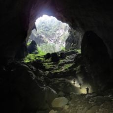
Son Doong Cave
21.4 km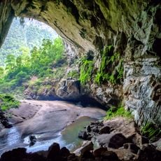
Hang Én (swift cave)
18.8 km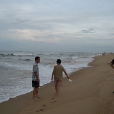
Nhat Le Beach
20.7 km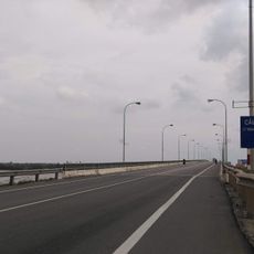
Quan Hau Bridge
21.9 km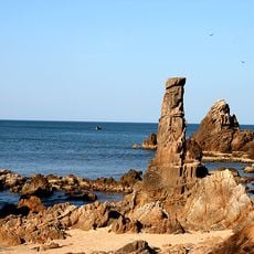
Da Nhay Beach
20.7 km
Tabico Resort
19 km
Di tích phà Long Đại
19.2 km
Hang Én Cave
19.9 km
Ben Pha Pagoda
19 km
Ngã ba Rình Rình Nhánh Đông HCM
18.8 km
Long Dai Bridge
19.1 km
Long Dai Railway Bridge
19.1 km
Bridge
11 km
Nhà ông bà ngoại Subell
22.3 km
Thang Cong
11.7 km
Son Doong Cave
20 km
En Cave (starting point)
20.1 km
Scenic viewpoint
11.8 km
Over artificial terraces
20.6 km
Scenic viewpoint
8 km
Scenic viewpoint
12.4 km
Scenic viewpoint
20.1 km
Sea view
15.6 km
Scenic viewpoint
8.3 km
Scenic viewpoint
19.6 km
Scenic viewpoint
19.4 km
Waterfall
18.7 km
Waterfall
12.4 kmReviews
Visited this place? Tap the stars to rate it and share your experience / photos with the community! Try now! You can cancel it anytime.
Discover hidden gems everywhere you go!
From secret cafés to breathtaking viewpoints, skip the crowded tourist spots and find places that match your style. Our app makes it easy with voice search, smart filtering, route optimization, and insider tips from travelers worldwide. Download now for the complete mobile experience.

A unique approach to discovering new places❞
— Le Figaro
All the places worth exploring❞
— France Info
A tailor-made excursion in just a few clicks❞
— 20 Minutes