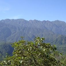
Bridge
Location: Huyện Tam Đường
Address: Bản Chu Va 8
GPS coordinates: 22.33963,103.66956
Latest update: November 14, 2025 21:02
Hoang Lien National Park
11.6 km
Động Hương Tiên Sơn
5.8 km
Tác Tình Waterfall
5.8 km
Dong Cave
3 km
Dong Tien Son Shrine
3.1 km
Rong May Glass Bridge
9.7 km
Lonely Tree
9.6 km
Grand Buddha Statue
11.6 km
Work of art, sculpture
11.5 km
View Point, altitute 2143m
11.4 km
Scenic viewpoint
11.6 km
Trạm Tôn
9.5 km
Heaven's Gate
9.9 km
Scenic viewpoint
10.6 km
Point of view over the tea fields
8.9 km
Tea Fields View
8.8 km
Scenic viewpoint
9.4 km
Scenic viewpoint
4.6 km
Scenic viewpoint
5 km
Scenic viewpoint
4.7 km
Scenic viewpoint
11.4 km
Đài tưởng niệm Liệt sĩ
5.5 km
Buddha
10 km
Thác Tình Yêu
10.6 km
Waterfall
6.3 km
Waterfall
9.8 km
Waterfall
10.9 km
Thác Bạc
11.4 kmReviews
Visited this place? Tap the stars to rate it and share your experience / photos with the community! Try now! You can cancel it anytime.
Discover hidden gems everywhere you go!
From secret cafés to breathtaking viewpoints, skip the crowded tourist spots and find places that match your style. Our app makes it easy with voice search, smart filtering, route optimization, and insider tips from travelers worldwide. Download now for the complete mobile experience.

A unique approach to discovering new places❞
— Le Figaro
All the places worth exploring❞
— France Info
A tailor-made excursion in just a few clicks❞
— 20 Minutes