Detention dam
Location: Central Hawke's Bay District
GPS coordinates: -39.96193,176.79846
Latest update: November 17, 2025 19:42

Town Clock and War Memorial
18 km
Mangakuri Beach
9.6 km
Mangakuri Station Chapel and Belfry
8.5 km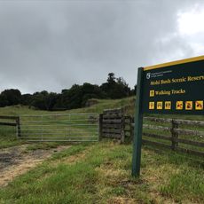
Mohi Reserve
14.5 km
Abbotslee
17.8 km
Maraetotara Scenic Reserve
13.3 km
Parkers Bush Scenic Reserve
15.9 km
Mangatarata Station Homestead
14.8 km
Te Nakahi Parahi and Urupa
17.1 km
Woolshed
8.8 km
Mangakuri Station Homestead
8.6 km
Roto-a-Tara / Te Motu o Te Awarua o Porirua
17.4 km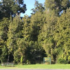
Elsthorpe Reserve
5 km
Mangatarata Station Stables
14.9 km
Kahotea
16.3 km
Detention dam
8.4 km
Wairunga Golf Course
15.1 km
Detention dam
2.7 km
Detention dam
6.8 km
Vehicle access along beach at low tide
16.1 km
Mohi Bush Scenic Reserve
14.3 km
Archaeological site
16.5 km
Archaeological site
15.3 km
Archaeological site
16.1 km
Archaeological site
16.5 km
Archaeological site
17.5 km
Captured German Field Gun
18 km
Waterfall
16.8 kmReviews
Visited this place? Tap the stars to rate it and share your experience / photos with the community! Try now! You can cancel it anytime.
Discover hidden gems everywhere you go!
From secret cafés to breathtaking viewpoints, skip the crowded tourist spots and find places that match your style. Our app makes it easy with voice search, smart filtering, route optimization, and insider tips from travelers worldwide. Download now for the complete mobile experience.

A unique approach to discovering new places❞
— Le Figaro
All the places worth exploring❞
— France Info
A tailor-made excursion in just a few clicks❞
— 20 Minutes